 Filter: Categories of Wisconsin Historical Images
Filter: Type of Map or Atlas
Filter: County of Winnebago
Filter: Categories of Wisconsin Historical Images
Filter: Type of Map or Atlas
Filter: County of Winnebago

| Date: | 1870 |
|---|---|
| Description: | This bird's-eye-view map shows roads, a river with boats, and homes. The bottom margin of the map includes an index. |

| Date: | 03 1911 |
|---|---|
| Description: | This 1911 topographic map shows Lake Winnebago and the surrounding area. The township and range grid, counties, towns, sections, cities, villages and post ... |

| Date: | 1873 |
|---|---|
| Description: | This 1873 map of Winnebago County, Wisconsin, shows the township and range grid, towns, sections, cities and villages, landownership and acreages, roads, r... |

| Date: | 06 1875 |
|---|---|
| Description: | These manuscript drawings show the profile of the Neenah Dam, between Lake Winnebago and Little Lake Butte des Morts on the Fox River in Winnebago County, ... |

| Date: | 08 24 1899 |
|---|---|
| Description: | Pen-and-ink and color on paper. Also shows probable routes of the French explorers Constant le Marchand de Lignery in 1728 and Louis de la Porte de Louvign... |

| Date: | 1920 |
|---|---|
| Description: | Shows lot and block numbers. Includes manuscript annotations showing original Wisconsin Central Railway line in red which reads: "Original W.C. Line in Men... |
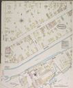
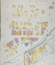
| Date: | 1884 |
|---|---|
| Description: | Sanborn-Perris fire insurance map for city of Menasha. |
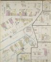
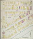
| Date: | 1884 |
|---|---|
| Description: | Sanborn-Perris fire insurance map for city of Menasha. |
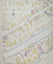
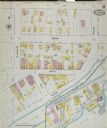
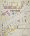
| Date: | 1887 |
|---|---|
| Description: | Sanborn-Perris fire insurance maps for city of Menasha. |
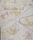
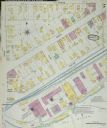
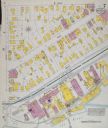
| Date: | 1887 |
|---|---|
| Description: | Sanborn-Perris fire insurance maps for city of Menasha. |
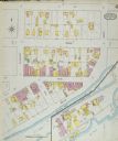
| Date: | 1891 |
|---|---|
| Description: | Sanborn-Perris fire insurance maps for city of Menasha. |
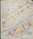
| Date: | 1891 |
|---|---|
| Description: | Sanborn-Perris fire insurance maps for city of Menasha. |
| Date: | 1895 |
|---|---|
| Description: | Sanborn-Perris fire insurance maps for city of Menasha. |
| Date: | 1895 |
|---|---|
| Description: | Sanborn-Perris fire insurance maps for city of Menasha. |
| Date: | |
|---|---|
| Description: | Sanborn-Perris fire insurance maps for city of Menasha. |
| Date: | 1900 |
|---|---|
| Description: | Sanborn-Perris fire insurance maps for city of Menasha. |
| Date: | 1900 |
|---|---|
| Description: | Sanborn-Perris fire insurance maps for city of Menasha. |
| Date: | |
|---|---|
| Description: | Sanborn-Perris Map of Menasha from 1900 page 7. |

| Date: | 1875 |
|---|---|
| Description: | This map, from G.K. Warren's 1876 Report on the transportation route along the Wisconsin and Fox rivers in the State of Wisconsin between the Mississippi R... |
If you didn't find the material you searched for, our Library Reference Staff can help.
Call our reference desk at 608-264-6535 or email us at:
