Filter: Categories of Wisconsin Historical Images
Filter: COLLECTION_NAME of Sanborn-Perris Maps
Filter: Creator Name of Sanborn Map Company
Filter: Categories of Wisconsin Historical Images
Filter: COLLECTION_NAME of Sanborn-Perris Maps
Filter: Creator Name of Sanborn Map Company
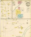
| Date: | 1915 |
|---|---|
| Description: | A Sanborn map of a portion of Janesville, including the Rock River Sugar Company. |

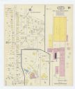
| Date: | 1908 |
|---|---|
| Description: | A Sanborn map featuring the Capitol Square and surrounding business district. |

| Date: | 1901 |
|---|---|
| Description: | A Sanborn map of Tomahawk featuring the Bay Mill Company's lumber yard. |

| Date: | 1910 |
|---|---|
| Description: | Sanborn insurance map of Milwaukee showing a portion of Jones Island with Lake Michigan at the top and the Milwaukee River at the bottom. |
If you didn't find the material you searched for, our Library Reference Staff can help.
Call our reference desk at 608-264-6535 or email us at: