Filter: Categories of Wisconsin Historical Images
Filter: COLLECTION_NAME of Place File****
Filter: Subject of fields (agriculture)
Filter: Categories of Wisconsin Historical Images
Filter: COLLECTION_NAME of Place File****
Filter: Subject of fields (agriculture)

| Date: | 1862 |
|---|---|
| Description: | Camp Randall looking southwest. In April 1861, Governor Alexander Randall asked that the State Agricultural Society fairgrounds be converted into a militar... |

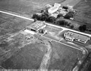
| Date: | 1908 |
|---|---|
| Description: | Aerial view of Camp Randall Field on the University of Wisconsin-Madison campus. University Heights is in the background. |
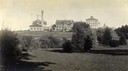
| Date: | 1903 |
|---|---|
| Description: | View towards the College of Agriculture on the University of Wisconsin campus, with Bascom Hall in the distance on a hill. |
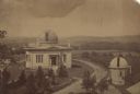
| Date: | 1880 |
|---|---|
| Description: | Elevated view of the University of Wisconsin-Madison Washburn Observatory. Hill, trees and fields are in the background. A man is standing near a small obs... |
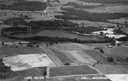
| Date: | 1947 |
|---|---|
| Description: | Aerial view of Lake Seven, surrounded by trees. Agricultural fields fill the foreground. Another lake is in the upper right. Caption reads: "Lake Seven Ade... |
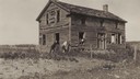
| Date: | 1920 |
|---|---|
| Description: | View of an old home or inn. Two people are looking out of an open window, and two men are standing outside leaning against the building. |
| Date: | |
|---|---|
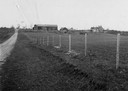
| Description: | Distant view of Waterbury mansion, with field, road and fencing in the foreground. |
| Date: | 1945 |
|---|---|
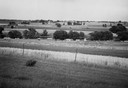
| Description: | Field prior to the park's reconstruction, with a fence in the foreground. A river is at the bottom of the hill. |
| Date: | |
|---|---|
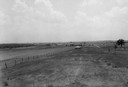
| Description: | View of Aztalan State Park site when it was called Aztalan Mound Park. |

| Date: | 1965 |
|---|---|
| Description: | Aerial view of downtown Big Falls and the Little Wolf River. The Little Wolf River is at lower right. |

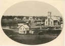
| Date: | 1905 |
|---|---|
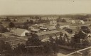
| Description: | Aerial view of town, with several large buildings along railroad tracks in the foreground, and fields and trees in the distance. Pedestrians are walking al... |
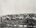
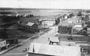
| Date: | 1907 |
|---|---|
| Description: | Caption reads: "Birdseye [sic] View of Cameron Wisconsin." Railroad cars are on railroad tracks between buildings, and houses and what may be the hi... |
| Date: | 1907 |
|---|---|
| Description: | Elevated view of Cameron. Rooftops are in the foreground, and an unpaved street is along the left. Railroad tracks cut across the street, with railroad car... |
If you didn't find the material you searched for, our Library Reference Staff can help.
Call our reference desk at 608-264-6535 or email us at: