Filter: Categories of Wisconsin Historical Images
Filter: COLLECTION_NAME of Place File*
Filter: Creator Name of Unknown
Filter: Type of Map or Atlas
Filter: Categories of Wisconsin Historical Images
Filter: COLLECTION_NAME of Place File*
Filter: Creator Name of Unknown
Filter: Type of Map or Atlas

| Date: | 02 26 1887 |
|---|---|
| Description: | Bird's-eye map of Ashland, and the Apostle Islands in Lake Superior. Caption reads: "Ashland and the Apostle Islands." |

| Date: | 1890 |
|---|---|
| Description: | Bird's-eye view of Sheboygan on an advertisement for Kempf's Magical Salve, distributed by E.J. Kempf, "Legitimate Bill Poster and Distributor." |

| Date: | 1836 |
|---|---|
| Description: | The map of Wisconsin City on the Wisconsin River. |

| Date: | 1859 |
|---|---|
| Description: | Map featuring various views of buildings and scenes from Sauk County. |

| Date: | 1925 |
|---|---|
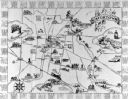
| Description: | A map of the farm planned by Edwin Bottomley in 1844. |

| Date: | 1925 |
|---|---|
| Description: | Sketch of the first floor plan of the house of Mr. Edwin Bottomley. |

| Date: | 1821 |
|---|---|
| Description: | A topographical view of the site of Fort Crawford. |

| Date: | |
|---|---|
| Description: | Wisconsin Memorial Hospital with a key to buildings in the upper left. Indian mounds are marked on the site. Arthur Peabody was the state architect for th... |

| Date: | 1959 |
|---|---|
| Description: | University of Wisconsin-Madison campus. Numbers in circles identify buildings across campus with the building index. Black arrows point out important infor... |
If you didn't find the material you searched for, our Library Reference Staff can help.
Call our reference desk at 608-264-6535 or email us at: