 Filter: Categories of Wisconsin Historical Images
Filter: COLLECTION_NAME of Map Collection
Filter: Year of 1900-1999
Filter: Categories of Wisconsin Historical Images
Filter: COLLECTION_NAME of Map Collection
Filter: Year of 1900-1999
| Date: | 1935 |
|---|---|
| Description: | This manuscript map shows route of the early military road in Wisconsin from Green Bay (Fort Howard) through Portage (Fort Winnebago) to Fort Blue Mounds a... |

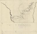
| Date: | 1920 |
|---|---|
| Description: | Shows 10 land and water trails along rivers and other bodies of water in northern Wisconsin and the Upper Peninsula of Michigan; each trail numbered and de... |

| Date: | 1942 |
|---|---|
| Description: | This map shows the Wisconsin and Fox River routes in green, and the Milwaukee and Rock River Canal routes in red. Prairie du Chien, Fort Winnebago, Grand C... |

| Date: | 1994 |
|---|---|
| Description: | This brochure presents a series of 16 maps of the Glacial Drumlin Trail and the New Berlin Trail. The Glacial Drumlin Trail consists of 53 miles of bike tr... |

| Date: | 1916 |
|---|---|
| Description: | This map shows the locations of hunting and fishing resorts in the northern Wisconsin counties of Forest, Iron, Oneida, and Vilas, and in Gogebic County in... |
| Date: | 1931 |
|---|---|
| Description: | This map "sets out the more important points of historic interest designated by the National Society of Colonial Dames in Wisconsin" and includes illustrat... |
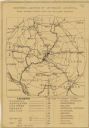
| Date: | 1920 |
|---|---|
| Description: | This map produced just after Word War I shows the proposed location for a veterans' hospital in the Eau Claire-Chippewa Falls region. Highways, rail lines ... |
| Date: | 1925 |
|---|---|
| Description: | Booklet includes maps of Madison, Fond du Lac, Oshkosh, Appleton, Green Bay, Milwaukee, Janesville, Beloit, and La Crosse, Wisconsin and downtown Chicago a... |

| Date: | 1920 |
|---|---|
| Description: | A two-sided map of the state of Wisconsin. The front includes towns and major cities as well as state and county trunk highways. The back includes a smalle... |

| Date: | 1910 |
|---|---|
| Description: | Map of part of the northwestern section of Wisconsin, comprising counties of St. Croix, Dunn, Pierce, and Pepin. Relief shown by hachures. |

| Date: | 1920 |
|---|---|
| Description: | This map identifies the areas of the state that had been geologically surveyed or topographically surveyed, or both, as well as portions of the state still... |

| Date: | 1928 |
|---|---|
| Description: | Map of portions of Wisconsin and Minnesota between Lake Superior and Mississippi River, showing railroads and military road. |

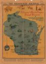
| Date: | 1941 |
|---|---|
| Description: | This pictorial map of Wisconsin with historical text highlights the history of the state and identifies places of interest, Indian villages, missions, trad... |

| Date: | 1994 |
|---|---|
| Description: | This brochure consists of a series of 16 maps of the Military Ridge State Park Trail and the Sugar River State Trail. In all, 62 miles of bike trails and 1... |

| Date: | 1940 |
|---|---|
| Description: | This map of southeastern Wisconsin depicts the Rock and Milwaukee rivers and the Kettle Moraine area. Cities and villages are identified. Stamp stating "Po... |

| Date: | 1949 |
|---|---|
| Description: | This color map includes historical descriptions of select areas and a short article on the history of Wisconsin. The major highways in the state shown on t... |

| Date: | 1991 |
|---|---|
| Description: | This canoe guide depicts the Wisconsin River from just north of Prairie du Sac to near Spring Green. Landmarks and points of interest are identified and de... |

| Date: | 1910 |
|---|---|
| Description: | This early 20th-century map of Wisconsin counties indicates indicate the Wisconsin counties in which there are county historical societies auxiliary to the... |

| Date: | 1935 |
|---|---|
| Description: | This map shows in different colors virgin timberland, second growth timber, pasture belt, crop-pasture belt, intensive crop-pasture belt, intensive pasture... |

| Date: | 1938 |
|---|---|
| Description: | This map shows "regional designation problem areas" and "nature of problem or solution." The left margin has a key showing the problem areas. The right mar... |
If you didn't find the material you searched for, our Library Reference Staff can help.
Call our reference desk at 608-264-6535 or email us at: