Filter: Categories of Wisconsin Historical Images
Filter: COLLECTION_NAME of Map Collection
Filter: Year of 1800-1899
Filter: Year of 1870-1879
Filter: Categories of Wisconsin Historical Images
Filter: COLLECTION_NAME of Map Collection
Filter: Year of 1800-1899
Filter: Year of 1870-1879

| Date: | 09 1871 |
|---|---|
| Description: | Bird's-eye view of Peshtigo, before it was destroyed by fire on the night of October 8, 1871. |

| Date: | 1870 |
|---|---|
| Description: | This bird's-eye-view map shows roads, a river with boats, and homes. The bottom margin of the map includes an index. |

| Date: | 1874 |
|---|---|
| Description: | This map shows lakes, rivers, state, county, and town boundaries, as well as railroads completed, in progress, and contemplated. The map includes a color d... |

| Date: | 1870 |
|---|---|
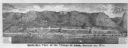
| Description: | During the War of 1812, the only battle fought in Wisconsin was in Prairie du Chien, in 1814. Made fifty-six years later, this birds eye drawing depicts th... |

| Date: | 1873 |
|---|---|
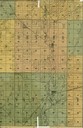
| Description: | Map of the township of Windsor, from the "Atlas of Dane County." |

| Date: | 1876 |
|---|---|
| Description: | Bird's-eye view of Black Earth. |

| Date: | 1870 |
|---|---|
| Description: | Baraboo was first settled around 1838, and by 1870 it had become the county seat and the thriving village illustrated here. This birds eye drawing depicts ... |

| Date: | 1876 |
|---|---|
| Description: | Bird's-eye view of Middleton with an inset of a school house. |
| Date: | 1877 |
|---|---|
| Description: | Bird's-eye panorama of Alma, from "An Illustrated Historical Atlas of Buffalo and Pepin Counties." |

| Date: | 1870 |
|---|---|
| Description: | Birds eye drawing of Fort Atkinson, Jefferson County, depicts street names and street layouts, houses, trees, Rock River and Bark River. A reference key at... |

| Date: | 1870 |
|---|---|
| Description: | Bird's-eye map of Hudson, with insets of Court House and Public School. |

| Date: | 1870 |
|---|---|
| Description: | Although the first European settlement in Jefferson was in 1836, the Village of Jefferson was first incorporated as a city in 1878. Made eight years earlie... |

| Date: | 1873 |
|---|---|
| Description: | Bird's-eye map of La Crosse from the Mississippi River. |

| Date: | 1870 |
|---|---|
| Description: | Bird's-eye map of Prairie du Sac. |

| Date: | 1872 |
|---|---|
| Description: | Bird's-eye map of Milwaukee on Lake Michigan. |

| Date: | 1874 |
|---|---|
| Description: | Bird's-eye map of Reedsburg, on the Baraboo River. |
If you didn't find the material you searched for, our Library Reference Staff can help.
Call our reference desk at 608-264-6535 or email us at: