 Filter: Categories of Wisconsin Historical Images
Filter: COLLECTION_NAME of Map Collection
Filter: Year of 1800-1899
Filter: Year of 1830-1839
Filter: Categories of Wisconsin Historical Images
Filter: COLLECTION_NAME of Map Collection
Filter: Year of 1800-1899
Filter: Year of 1830-1839

| Date: | 1835 |
|---|---|
| Description: | Map reads: "Map of the United States of America with its Territories and Districts - Including also a part of Upper and Lower Canada and Mexico". The map i... |

| Date: | 1839 |
|---|---|
| Description: | Map of a canal route to avoid the principal rapids of the Neenah or Fox River between Lake Winnebago and Green Bay. |
| Date: | 1838 |
|---|---|
| Description: | Map of the entire territories of Iowa and Wisconsin. |

| Date: | 1837 |
|---|---|
| Description: | Map of the proposed route of the Milwaukee and Rock River Canal. |

| Date: | 1835 |
|---|---|
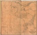
| Description: | This map of Wisconsin Territory was compiled by public surveys in 1835; it is limited to modern-day southern Wisconsin. Included are two insets – one of th... |

| Date: | 1839 |
|---|---|
| Description: | This map shows the portion of Wisconsin south and east of the Wisconsin and Fox rivers. Roads, forts, cities both existing and "planned" and counties are i... |
| Date: | 1838 |
|---|---|
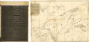
| Description: | This map of the Wisconsin Territory, accompanied by the photostat of an article from the January 13, 1838, Wisconsin democrat, shows the area described as ... |

| Date: | 1839 |
|---|---|
| Description: | A chart showing the geological cross-section and the height above the surrounding landscape of several locations, such as Platte Mound in Wisconsin, and th... |

| Date: | 1835 |
|---|---|
| Description: | Ink on tracing paper map of Green Bay, Wisconsin and nearby areas, Lake Winnebago, Fox and Wolf Rivers, and the junctions of the Mississippi and Wisconsin ... |

| Date: | 1835 |
|---|---|
| Description: | This hand-colored map shows the area from Michigan west to the Missouri River and Lake Winnipeg, and includes expedition routes of Stephen H. Long and Henr... |

| Date: | 1836 |
|---|---|
| Description: | This map depicts Wisconsin and Michigan territories in 1836. It includes the area from Michigan to the Missouri River and Lake Winnipeg, and it shows the e... |

| Date: | 1836 |
|---|---|
| Description: | This hand-colored manuscript map shows the township and section grid in southeastern Wisconsin, covering the area west to Sugar River and Four Lakes region... |

| Date: | 1837 |
|---|---|
| Description: | This map shows the townships, roads, trails, natural land forms, vegetation, mill sites and lead and copper deposits in the Wisconsin Territory at the time... |

| Date: | 1837 |
|---|---|
| Description: | Map of Lake Winnebago and the area south of the Fox River from Green Bay to Sheboygan. The map is oriented with North to the right. |

| Date: | 1838 |
|---|---|
| Description: | This manuscript map, drawn in pencil, shows the lakes and rivers in the area between Lake of the Woods in northern Minnesota, the Mississippi River on the ... |

| Date: | 1839 |
|---|---|
| Description: | This map shows the township and section grid, lakes, rivers, swamps, prairies, roads, and proposed canals in the area of Wisconsin south of Lake Winnebago ... |
| Date: | 1837 |
|---|---|
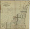
| Description: | This map shows the townships, counties, prairies, and swamps in the Wisconsin Territory at the time. It includes the land south of the Wisconsin and Fox Ri... |

| Date: | 1839 |
|---|---|
| Description: | Wisconsin was considered part of Michigan Territory until 1836, a year before Michigan entered statehood. Drawn in 1839, this map shows the state of Michig... |

| Date: | 1835 |
|---|---|
| Description: | Plat for a proposed Sinsinawa City (never built), in Grant County, Wis. When it became clear in the mid-1830s that Wisconsin Territory would be established... |

| Date: | 1832 |
|---|---|
| Description: | A hand-drawn map showing the survey of Township number 4, Range number 5, West Fourth Principal Meridian, which is parts of the present day towns of Glen H... |
If you didn't find the material you searched for, our Library Reference Staff can help.
Call our reference desk at 608-264-6535 or email us at: