 Filter: Categories of Wisconsin Historical Images
Filter: COLLECTION_NAME of Map Collection
Filter: Year of 1800-1899
Filter: Type of Map or Atlas
Filter: Categories of Wisconsin Historical Images
Filter: COLLECTION_NAME of Map Collection
Filter: Year of 1800-1899
Filter: Type of Map or Atlas

| Date: | 1856 |
|---|---|
| Description: | Wisconsin map illustrating the Mineral Point Railroad and its connections. |

| Date: | 1814 |
|---|---|
| Description: | Map of the Upper Territories of the United States. |

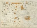
| Date: | 1879 |
|---|---|
| Description: | Bird's-eye view drawing of various buildings on the University of Wisconsin-Madison. Buildings include: Ladies Hall, South Dormitory, University Hall, Asse... |

| Date: | 1832 |
|---|---|
| Description: | Route of Military Road from Fort Crawford to Fort Howard. Map shows beginning of route at Fort Crawford. |

| Date: | 1830 |
|---|---|
| Description: | Multicolor map illustrates the development of states and territories in the Old Northwest. Wisconsin was on the frontier of settlement when this map was pu... |

| Date: | 1857 |
|---|---|
| Description: | A quarter section of a map of the city of Fond du Lac. This section features an illustration of Amory Hall and the Exchange Bank of Darling & Co. |

| Date: | 1857 |
|---|---|
| Description: | A quarter section of a map of the City of Fond du Lac featuring the Empire Branch Plank Road. |

| Date: | 1857 |
|---|---|
| Description: | Quarter section of a map of the city of Fond du Lac featuring the Waupun Plank Road. |

| Date: | 1857 |
|---|---|
| Description: | Quarter section of a map of the city of Fond du Lac featuring an illustration of the Lewis House. |

| Date: | 1844 |
|---|---|
| Description: | Map of Wisconsin including Lakes Michigan and Superior. Inset includes "N.W. Part of Wiskonsan." |

| Date: | 1879 |
|---|---|
| Description: | Map of Oconto and Marinette counties. |

| Date: | 1856 |
|---|---|
| Description: | Isthmus of Madison, including Lake Mendota, or Great Lake, and Lake Menona [sic]. |

| Date: | 1890 |
|---|---|
| Description: | Portion of a plat map of Madison featuring Lake Mendota. |

| Date: | 1890 |
|---|---|
| Description: | Left half of a plat map of the "East Part of the city of Madison". |

| Date: | 1890 |
|---|---|
| Description: | Right side of a plat map of the "East Part of the City of Madison". |

| Date: | 1890 |
|---|---|
| Description: | Portion of a plat map of the "West Part of the City of Madison". |
| Date: | 1882 |
|---|---|
| Description: | Map showing Indian Reservations in the United States. |

| Date: | 1877 |
|---|---|
| Description: | Map showing location of Indian reservations in the United States and population figures. |
If you didn't find the material you searched for, our Library Reference Staff can help.
Call our reference desk at 608-264-6535 or email us at:

