Filter: Categories of Wisconsin Historical Images
Filter: COLLECTION_NAME of Map Collection
Filter: Subject of rivers
Filter: Categories of Wisconsin Historical Images
Filter: COLLECTION_NAME of Map Collection
Filter: Subject of rivers

| Date: | 1854 |
|---|---|
| Description: | Map reads, "Map of Wisconsin". The map includes the counties, an inset of the city of Milwaukee, total population of each county and of the state. The scal... |

| Date: | |
|---|---|
| Description: | Map reads: "Historic and Scenic Wisconsin — Land of Gathering Waters." In an inset there is a hand-painted depiction of the Wisconsin State Seal. For some ... |

| Date: | 1842 |
|---|---|
| Description: | Map reads: "Wisconsin". The map depicts the counties as of 1842 and the various areas of Indian settlements. The scale is twenty miles for every inch. |

| Date: | 1864 |
|---|---|
| Description: | Map reads: "Johnson's Wisconsin and Michigan". There is a decorative border, a scale of which ten miles is approximately one inch and individual counties d... |

| Date: | 1919 |
|---|---|
| Description: | This is a collection of three hand-colored plat maps. One map is a plat plan and includes annotations and an index that shows public land, business, indust... |

| Date: | 1861 |
|---|---|
| Description: | A map of Wisconsin showing cities, counties, major roads, railroads, and bodies of water. Includes an inset of the vicinity of Milwaukee. |

| Date: | 1825 |
|---|---|
| Description: | Portion of a map showing a survey of Lake Superior including the River St. Louis. |
| Date: | 1825 |
|---|---|
| Description: | Survey of Lake Superior including Wisconsin and Minnesota. |
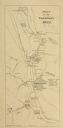
| Date: | 1876 |
|---|---|
| Description: | Map of the area around the head of Lake Superior, including the cities of Superior and Duluth. |

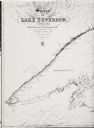
| Date: | 1857 |
|---|---|
| Description: | A color-coded map of the Lake Superior region, including portions of Wisconsin, Minnesota and Michigan. |

| Date: | 1873 |
|---|---|
| Description: | Portion of Winnebago County map showing Lake Winneconne and the Wolf River. |
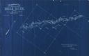
| Date: | 1898 |
|---|---|
| Description: | Topographical map of the Brule River, with white print on blue paper. There is a portion of text on the map that reads "I hereby certify that the above map... |

| Date: | 1837 |
|---|---|
| Description: | Map of the proposed route of the Milwaukee and Rock River Canal. |

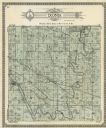
| Date: | 1890 |
|---|---|
| Description: | This map shows lakes, railroads, and rivers. An explanation of railroad lines with mileage in Wisconsin and total mileage for 1890 is included. Portions of... |

| Date: | 1937 |
|---|---|
| Description: | Official state highway map, with insets of cities. |

| Date: | 1932 |
|---|---|
| Description: | This map includes a distance table, text, and insets maps of, Superior, Ashland, Marinette, Green Bay, Appleton, Manitowoc, Oshkosh, Fond Du Lac, Janesvill... |

| Date: | 1907 |
|---|---|
| Description: | Topographic map of the Wisconsin River done under direction of Daniel Meade for construction of the Kilbourn dam by the Southern Wisconsin Power Company. I... |

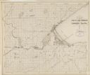
| Date: | 1926 |
|---|---|
| Description: | This hand-colored blueprint map shows landowners in part of T15N, R5E in Juneau County. North is oriented to the right. |
If you didn't find the material you searched for, our Library Reference Staff can help.
Call our reference desk at 608-264-6535 or email us at: