 Filter: Categories of Wisconsin Historical Images
Filter: COLLECTION_NAME of Map Collection
Filter: Subject of maps
Filter: Year of 1900-1999
Filter: Categories of Wisconsin Historical Images
Filter: COLLECTION_NAME of Map Collection
Filter: Subject of maps
Filter: Year of 1900-1999

| Date: | 1924 |
|---|---|
| Description: | Front and back covers of Scenic Wisconsin Motorways, a guide to Wisconsin roads compiled by Victor F. Pettric and published by the Wisconsin Motorists Asso... |
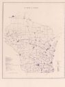
| Date: | 1923 |
|---|---|
| Description: | This map shows the county boundaries, with each dot representing 50 silos. |

| Date: | 1975 |
|---|---|
| Description: | This map is a reduced reproduction of an annotated map showing location and dates of the operation of Door County post offices. The map includes an article... |

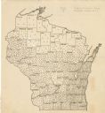
| Date: | 1902 |
|---|---|
| Description: | This map shows townships, land parcels, schools, rivers, lakes, creameries, churches, cemeteries, roads, post offices, town halls, saw mills, roads and sto... |

| Date: | 12 1912 |
|---|---|
| Description: | Sanborn map of Sun Prairie, which includes an index and information about water facilities and the fire department. Includes a small inset map of the State... |

| Date: | 1933 |
|---|---|
| Description: | A road map of Wisconsin, that shows the major and some minor roads of the state, population of the cities and towns, a scale and an index. The reverse side... |

| Date: | 1934 |
|---|---|
| Description: | This map features a road map with a legend and scale. The bigger cities and towns are highlighted in green. The back of the map includes an index, advertis... |

| Date: | 1934 |
|---|---|
| Description: | A road map of Wisconsin sponsored by Conoco. The front side includes and index, scale, and legend. The reverse side includes United States road map, and i... |

| Date: | 1934 |
|---|---|
| Description: | Road map of Wisconsin compliments of Phillips Petroleum Company. The front side includes an index and scale. The reverse side shows a generic road map of t... |

| Date: | 1928 |
|---|---|
| Description: | A Wisconsin state highway map, featuring the major highways, rivers, lakes, and cities. There are a few advertisements on the front and back. The back also... |
| Date: | 1974 |
|---|---|
| Description: | This blue line map show gas services and county boundaries. Includes a legend of company names in lower left hand corner. |
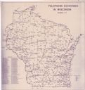
| Date: | 11 1973 |
|---|---|
| Description: | This map shows the cities, county boundaries and telephone exchange locations. The map includes a numbered list of telephone companies. |
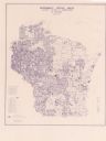
| Date: | 06 1975 |
|---|---|
| Description: | This map shows electrical utilities and cooperatives throughout the state, as well as cities and county boundaries. The bottom left corner of the map inclu... |

| Date: | 1906 |
|---|---|
| Description: | This map shows the cities, counties (outlined in yellow and labeled), rivers, lakes, and the major highways and freeways of Wisconsin and parts of the surr... |

| Date: | 1910 |
|---|---|
| Description: | This map of shows railway lines in red, with railroad land grant in Taylor, Price, and Ashland Counties shaded red, on top of the cities, counties, highway... |

| Date: | 1924 |
|---|---|
| Description: | This map shows railroads, electric lines, and steamship lines. The left margin includes an index of principal cities, and the lower left corner includes a... |

| Date: | 1920 |
|---|---|
| Description: | This map shows lands owned by the American Immigration Company (red) and the Homeseekers Land Company (green). The map also shows highways, roads, railroad... |

| Date: | 1914 |
|---|---|
| Description: | This map shows township grids, railroads, roads, and drainage. The area of the map covers northeastern Wisconsin and Menominee Indian reservation. Green Ba... |

| Date: | 1919 |
|---|---|
| Description: | This map shows auto trails, main roads, rivers, and populations of communities. The map also shows selected hotels and garages and includes a key in the ri... |

| Date: | 1915 |
|---|---|
| Description: | This map shows roads, railroads, street railways, abandoned logging railroads, rural mail routes, telephone lines, schools, platted land, and state forest ... |
If you didn't find the material you searched for, our Library Reference Staff can help.
Call our reference desk at 608-264-6535 or email us at: