 Filter: Categories of Wisconsin Historical Images
Filter: COLLECTION_NAME of Map Collection
Filter: Subject of landscape
Filter: Categories of Wisconsin Historical Images
Filter: COLLECTION_NAME of Map Collection
Filter: Subject of landscape

| Date: | 09 1871 |
|---|---|
| Description: | Bird's-eye view of Peshtigo, before it was destroyed by fire on the night of October 8, 1871. |

| Date: | 1885 |
|---|---|
| Description: | Bird's-eye map of Hustisford. |

| Date: | 1875 |
|---|---|
| Description: | Bird's-eye map of Mazomanie. |

| Date: | 1880 |
|---|---|
| Description: | Bird's-eye map of Neillsville, with inset. |

| Date: | 1884 |
|---|---|
| Description: | Panorama bird's-eye view of the town of Ashland, on Lake Superior, and the Apostle Islands. |

| Date: | 1832 |
|---|---|
| Description: | Route of Military Road from Fort Crawford to Fort Howard. Map shows beginning of route at Fort Crawford. |

| Date: | 1924 |
|---|---|
| Description: | Front and back covers of Scenic Wisconsin Motorways, a guide to Wisconsin roads compiled by Victor F. Pettric and published by the Wisconsin Motorists Asso... |
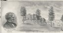
| Date: | 1878 |
|---|---|
| Description: | Engraving of Ocatagon House, the residence of Mrs. Eliza Richards. Several trees dot the landscape and other buildings can be seen in the distance at right... |
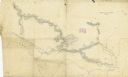
| Date: | 1862 |
|---|---|
| Description: | A hand-drawn map of the Yazoo River and vicinity. |

| Date: | 1842 |
|---|---|
| Description: | This map shows portions of northern Illinois and Wisconsin surveyed by the map's creation. It shows county lines and university land, and depicts lead and ... |

| Date: | 1902 |
|---|---|
| Description: | Map of Southern Norway with text in Norwegian. The scale of the map is 1:500000. |

| Date: | 1902 |
|---|---|
| Description: | Map of Southern Norway with text in Norwegian. Scale of map 1:500000. |

| Date: | 1874 |
|---|---|
| Description: | Bird's-eye view map of Appleton, Wisconsin. Map reads: "NOTE.-Since the above cut was engraved, the Fox River Pulp & Paper Co.'s Mammoth Mills have been er... |

| Date: | 1881 |
|---|---|
| Description: | Bird's-eye view of Milwaukee from the south lakeshore. |

| Date: | 1846 |
|---|---|
| Description: | This map is paint and ink on board with relief shown pictorially. The map was planned by Alfred Ames, drawn by one daughter and painted by another daughter... |

| Date: | 1920 |
|---|---|
| Description: | This map shows a plat of the area, numbered blocks and lots, local streets, roads, parks, Nakoma Country Club golf course, and landscaping. The map is orie... |

| Date: | 1918 |
|---|---|
| Description: | This is a collection of two maps. One map is blue line print that includes illustrations and shows the location of buildings, gardens, plant life, and spri... |
If you didn't find the material you searched for, our Library Reference Staff can help.
Call our reference desk at 608-264-6535 or email us at:


