Filter: Categories of Wisconsin Historical Images
Filter: COLLECTION_NAME of Map Collection
Filter: County of Dane
Filter: Categories of Wisconsin Historical Images
Filter: COLLECTION_NAME of Map Collection
Filter: County of Dane

| Date: | 1920 |
|---|---|
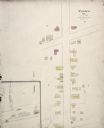
| Description: | Detail of a map of Dane county showing only Verona. |

| Date: | 1931 |
|---|---|
| Description: | An advertisement for H.C. Netherwood Printing Company (formerly) at 519 State Street in Madison, Wisconsin. |
| Date: | 1931 |
|---|---|
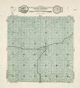
| Description: | A map of the township of Verona, Wisconsin. |

| Date: | 1931 |
|---|---|
| Description: | A map of the village of Verona, Wisconsin. |
| Date: | 1899 |
|---|---|
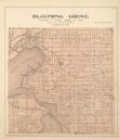
| Description: | Plat map of Blooming Grove Township in Dane County. |
| Date: | 1926 |
|---|---|
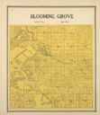
| Description: | Plat map of Blooming Grove Township in Dane County. |

| Date: | 1941 |
|---|---|
| Description: | Hand-drawn, watercolor and ink, map of Lake Mendota. Locations and many small figures appear around the shore with explanations referring to Indian legends... |

| Date: | 1906 |
|---|---|
| Description: | Hand-drawn topographical map of the Turville Estate. |

| Date: | 1892 |
|---|---|
| Description: | Topographical map of Madison and surrounding communities which include Lake Mendota, Lake Monona, Lake Waubesa and Lake Kegonsa. The red dots on the map sh... |

| Date: | 1844 |
|---|---|
| Description: | Part of a series of local maps, showing a number of burial mounds in the shape of animals near Madison, Wisconsin along military road. The maps also show d... |

| Date: | 1892 |
|---|---|
| Description: | This map oriented with north to the upper left shows railroads, creeks, post offices, smaller lakes, Lake Mendota, Lake Monona, Lake Wingra, Lake Waubesa, ... |

| Date: | 1900 |
|---|---|
| Description: | A Hydrographic map of Lake Mendota that shows the depths of the lake through contour lines and cross sections of the lake. Also shown in the map are the ad... |

| Date: | 1953 |
|---|---|
| Description: | A map of Lake Mendota that shows depths and the locations of various species of fish in lake. The maps also identifies a number of selected roads and stree... |

| Date: | 1941 |
|---|---|
| Description: | A pictorial map of Lake Mendota that shows Indian sites and legends associated with the Lake and its surrounding area. Some of those mentioned on the map i... |
If you didn't find the material you searched for, our Library Reference Staff can help.
Call our reference desk at 608-264-6535 or email us at: