 Filter: Categories of Wisconsin Historical Images
Filter: COLLECTION_NAME of Map Collection
Filter: County of Ashland
Filter: Year of 1900-1999
Filter: Categories of Wisconsin Historical Images
Filter: COLLECTION_NAME of Map Collection
Filter: County of Ashland
Filter: Year of 1900-1999

| Date: | 1981 |
|---|---|
| Description: | Plat map of Madeline Island surrounded by Basswood, Michigan and Gull Islands. |

| Date: | 1939 |
|---|---|
| Description: | This map shows the towns to Gingles, Sanborn, and Guney as well as Chequamegon Bay, Kakagon River, White River, Marengo River, Bad River, Potato River, Vau... |

| Date: | 1907 |
|---|---|
| Description: | A map of the eastern portion of the Apostle Islands group, and a detailed map of Gull Island showing the relief on the island, are included here, along wit... |

| Date: | 1952 |
|---|---|
| Description: | This 1952 map shows the trails, roads, and railroads through the counties of Ashland, Bayfield, Sawyer, Price, Iron, and Vilas. Also shown are lakes, river... |

| Date: | 1917 |
|---|---|
| Description: | This 1917 map of Ashland County, Wisconsin, shows the township and range system, towns, sections, cities and villages, the Bad River Indian Reservation, ra... |

| Date: | 1925 |
|---|---|
| Description: | This 1925 map of Ashland County, Wisconsin, shows the township and range system, towns, sections, cities and villages, the Bad River Indian Reservation, ra... |

| Date: | 1949 |
|---|---|
| Description: | This 1949 map shows the topography and significant landmarks in Copper Falls State Park, Ashland County, Wisconsin. |

| Date: | 1949 |
|---|---|
| Description: | This 1949 map shows the topography and significant landmarks in Copper Falls State Park, Ashland County, Wisconsin. On the verso is a black-and-white image... |

| Date: | 1956 |
|---|---|
| Description: | This map shows the types of upland and lowland forest vegetation on Stockton Island, one of the Apostle Islands in Lake Superior. |

| Date: | 1977 |
|---|---|
| Description: | This pictorial map was produced by the Chateau, a resort in La Pointe, and shows Madeline Island landmarks and tourist attractions. On the verso is the spr... |

| Date: | 1990 |
|---|---|
| Description: | This tourism brochure of Ashland County, Wisconsin, from the Ashland Area Chamber of Commerce includes a map of the county showing tourist destinations and... |

| Date: | 1900 |
|---|---|
| Description: | This chart of the northern Apostle Islands and Lake Superior shoreline shows relief by contours and spot heights and depths by contours, gradient tints and... |

| Date: | 1964 |
|---|---|
| Description: | This 1964 map of Madeline Island, Ashland County, Wisconsin, shows existing and historical locations, roads, the boundaries of a proposed state park, secti... |
| Date: | 1920 |
|---|---|
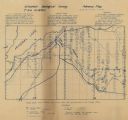
| Description: | Shows geology, test pits, shafts, houses, and the Mellen Lumber Co. Ry. in Marengo township, Ashland County, Wisconsin. "This is a preliminary map issued i... |

| Date: | 1908 |
|---|---|
| Description: | Title at top: "G.F. Sanborn Company Timber and Farming Lands." Map shows acreages, roads, railroads, and swamps in parts of Vilas and Oneida counties. |

| Date: | 1931 |
|---|---|
| Description: | This map of Ashland shows roads, railroads, and local businesses. The map reads: "Showing streets and roads open to the public Oct. 1, 1931." Included on t... |

| Date: | 1947 |
|---|---|
| Description: | This map of Ashland is a cadastral map showing some rural landowners and includes index to points of interest. The map shows roads, railroads, parks, cemet... |

| Date: | 1951 |
|---|---|
| Description: | This map shows Ashland and Washburn harbors in shades of blue and yellow. Water depths shown by isolines and soundings, and relief is shown by contours. Th... |

| Date: | 1916 |
|---|---|
| Description: | This map shows Chequamegon Bay, an inlet of Lake Superior. Depths are shown by isolines and soundings and relief shown by contours. The map is colored in y... |

| Date: | 1900 |
|---|---|
| Description: | This map is shows land in white and water in blue and is indexed for parks, points of interest, schools, churches, and recreational areas. The map shows lo... |
If you didn't find the material you searched for, our Library Reference Staff can help.
Call our reference desk at 608-264-6535 or email us at: