| Date: | 1981 |
|---|---|
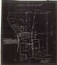
| Description: | Plat map of Madeline Island surrounded by Basswood, Michigan and Gull Islands. |

| Date: | 1917 |
|---|---|
| Description: | This 1917 map of Ashland County, Wisconsin, shows the township and range system, towns, sections, cities and villages, the Bad River Indian Reservation, ra... |

| Date: | 1925 |
|---|---|
| Description: | This 1925 map of Ashland County, Wisconsin, shows the township and range system, towns, sections, cities and villages, the Bad River Indian Reservation, ra... |

| Date: | 1977 |
|---|---|
| Description: | This pictorial map was produced by the Chateau, a resort in La Pointe, and shows Madeline Island landmarks and tourist attractions. On the verso is the spr... |

| Date: | 1990 |
|---|---|
| Description: | This tourism brochure of Ashland County, Wisconsin, from the Ashland Area Chamber of Commerce includes a map of the county showing tourist destinations and... |

| Date: | 1900 |
|---|---|
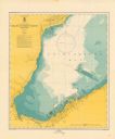
| Description: | This chart of the northern Apostle Islands and Lake Superior shoreline shows relief by contours and spot heights and depths by contours, gradient tints and... |

| Date: | 1964 |
|---|---|
| Description: | This 1964 map of Madeline Island, Ashland County, Wisconsin, shows existing and historical locations, roads, the boundaries of a proposed state park, secti... |

| Date: | 1931 |
|---|---|
| Description: | This map of Ashland shows roads, railroads, and local businesses. The map reads: "Showing streets and roads open to the public Oct. 1, 1931." Included on t... |

| Date: | 1947 |
|---|---|
| Description: | This map of Ashland is a cadastral map showing some rural landowners and includes index to points of interest. The map shows roads, railroads, parks, cemet... |

| Date: | 1951 |
|---|---|
| Description: | This map shows Ashland and Washburn harbors in shades of blue and yellow. Water depths shown by isolines and soundings, and relief is shown by contours. Th... |

| Date: | 1900 |
|---|---|
| Description: | This map is shows land in white and water in blue and is indexed for parks, points of interest, schools, churches, and recreational areas. The map shows lo... |

| Date: | 1900 |
|---|---|
| Description: | This map is pencil and ink on tracing cloth and shows local streets, railroads, harbor line, and part of Chequamegon Bay. |

| Date: | 1909 |
|---|---|
| Description: | This map shows vacant Wisconsin Central Ry. lands, settlers houses, lands sold by Wisconsin Central Ry., schools, churches, saw mills, and roads; also show... |

| Date: | 1910 |
|---|---|
| Description: | This map shows the locations of school houses, farms, roads, railroads, and Bad River Indian Reservation. Relief is shown by hachures. Yellow and red manus... |

| Date: | 1980 |
|---|---|
| Description: | This map shows the locations of 42 businesses, roads, points of interest, recreation sites, camping, the North Country Trail and parking, and boundaries of... |

| Date: | 1985 |
|---|---|
| Description: | This map shows mining, White River, Silver Creek, Bad River, Agogic Lake, Chequamegon Bay, smaller lakes, the Bad River Indian Reservation, and communities... |

| Date: | 1959 |
|---|---|
| Description: | This map shows landownership, acreages, and old fort road on the southwest corner of Madeline Island. The map includes an explanation of survey in the midd... |
If you didn't find the material you searched for, our Library Reference Staff can help.
Call our reference desk at 608-264-6535 or email us at: