 Filter: Categories of Wisconsin Historical Images
Filter: COLLECTION_NAME of Map Collection
Filter: Community of Milwaukee
Filter: Categories of Wisconsin Historical Images
Filter: COLLECTION_NAME of Map Collection
Filter: Community of Milwaukee

| Date: | 1948 |
|---|---|
| Description: | This map shows the land parcels, streets, and parks near the harbor. It includes a wind chart and 7 cross sections of borings/probings and docks. It also i... |
| Date: | 1940 |
|---|---|
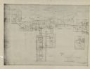
| Description: | This map is pen and ink on paper and is map 2 in a series of 12. The map shows streets, the Milwaukee River, and railroad tracks. |
| Date: | 1940 |
|---|---|
| Description: | This map is pen and ink on paper and is map 3 in a series of 12. The map shows streets, the Milwaukee River, and railroad tracks. |
| Date: | 1940 |
|---|---|
| Description: | This map is pen and ink on paper and is map 3 in a series of 12. The map shows streets, and the Milwaukee River. |
| Date: | 1940 |
|---|---|
| Description: | This map is pen and ink on paper and is map 5 in a series of 12. The map shows streets, the Milwaukee River, Lake Michigan, and railroad tracks. |
| Date: | 1940 |
|---|---|
| Description: | This map is pen and ink on paper and is map 6 in a series of 12. The map shows streets, and the Milwaukee River. |
| Date: | 1940 |
|---|---|
| Description: | This map is pen and ink on paper and is map 7 in a series of 12. The map shows streets and a railroad line. |
| Date: | 1940 |
|---|---|
| Description: | This map is pen and ink on paper and is map 8 in a series of 12. The map shows streets and a railroad line. |
| Date: | 1940 |
|---|---|
| Description: | This map is pen and ink on paper and is map 9 in a series of 12. The map shows streets and railroad lines. |
| Date: | 1940 |
|---|---|
| Description: | This map is pen and ink on paper and is map 10 in a series of 12. The map shows streets and railroad lines. |
| Date: | 1940 |
|---|---|
| Description: | This map is pen and ink on paper and is map 11 in a series of 12. The map shows streets. |
| Date: | 1940 |
|---|---|
| Description: | This map is pen and ink on paper and is map 12 in a series of 12. The map shows streets, railroad lines, the Kinnickinnic River, and Lake Michigan. |
| Date: | 1932 |
|---|---|
| Description: | This map shows a large map on the bottom with marked routes. City blocks are shown but not labeled. Lake Michigan is labeled on the far right. The top of t... |

| Date: | 1942 |
|---|---|
| Description: | This photostat map shows roads, ferry, impassible marsh land, the Menominee River, the Milwaukee River, and Lake Michigan. |
| Date: | 12 11 1933 |
|---|---|
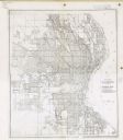
| Description: | This map shows residence, business, commercial, and industrial districts as well as streets, points of interest, and Lake Michigan. |

| Date: | 2000 |
|---|---|
| Description: | This map shows the industrial area along the Menominee River and canals. Industrial buildings are shown in orange and labeled in red. Other areas are shown... |

| Date: | 1965 |
|---|---|
| Description: | This series of 17 maps show boundaries and changes in city limits from 1846 to 1965. The base of all of the maps are the same, Milwaukee and suburbs. All m... |

| Date: | 2005 |
|---|---|
| Description: | This map shows dams and falls, areas of portage, canoe and kayak access, boat launches, parking, restrooms, picnic areas, dining, rapid water, parks, and b... |
| Date: | 1925 |
|---|---|
| Description: | This series of 11 maps plus an index show the rivers as well as riverside buildings, landownership, and streets. |
If you didn't find the material you searched for, our Library Reference Staff can help.
Call our reference desk at 608-264-6535 or email us at: