 Filter: Categories of Wisconsin Historical Images
Filter: COLLECTION_NAME of Map Collection
Filter: Community of Manitowoc
Filter: Categories of Wisconsin Historical Images
Filter: COLLECTION_NAME of Map Collection
Filter: Community of Manitowoc

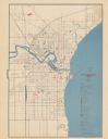
| Date: | 1883 |
|---|---|
| Description: | Bird's-eye map of Manitowoc. |

| Date: | 1868 |
|---|---|
| Description: | Bird's-eye map of Manitowoc, with four insets. Manitowoc County. |

| Date: | 01 1899 |
|---|---|
| Description: | Shows lot and block numbers, railroads, ward boundaries, and some landownership. Includes public building index. |
| Date: | 1945 |
|---|---|
| Description: | Map features a legend with symbols of points of interest. The symbols are in red. The back of the map has text on "Points of Interest and Information". |

| Date: | 1951 |
|---|---|
| Description: | Water depths shown by bathymetric tints, isolines, and soundings. Relief shown by contours. "Soundings in feet." "Aids to navigation corrected to May 4, 19... |

| Date: | 1905 |
|---|---|
| Description: | This map shows a plat of the city, local streets, railroads, public buildings, local businesses, and parts of the Manitowoc River and Lake Michigan. Relief... |

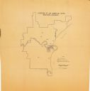
| Date: | |
|---|---|
| Description: | This plat map shows numbered blocks and lots, wards, local streets, railroads, cemeteries, buildings, land ownership by name, and parts of Manitowoc River ... |

| Date: | 1925 |
|---|---|
| Description: | This map shows a plat of the city, local streets, railroads, public buildings, local businesses, and parts of the Manitowoc River and Lake Michigan. Relief... |
| Date: | 08 1964 |
|---|---|
| Description: | This map shows the city limits, Lake Michigan, the Manitowoc River, Silver Creek, designated sample sites with manuscript annotations, central business dis... |

| Date: | 1856 |
|---|---|
| Description: | This map shows the Manitowoc River, Lake Michigan, streets, and buildings. Relief is shown by hachures and soundings are in feet and decimals of a foot. Th... |

| Date: | 09 1853 |
|---|---|
| Description: | This map shows streets, docks, warehouses, and piers near the harbor. The Manitowoc River and Lake Michigan are labeled. Depths are indicated by soundings ... |

| Date: | 1854 |
|---|---|
| Description: | This map shows streets, docks, warehouses, and piers near the harbor. Relief is shown by hachures and depths are shown by soundings and isolines. Lake Mich... |

| Date: | 1856 |
|---|---|
| Description: | This map shows streets, piers, and wharves. Lake Michigan, the Manitowoc River, and select buildings are labeled. Relief is shown by hachures and sounding... |

| Date: | 1865 |
|---|---|
| Description: | This map shows the river shore and piers. Lake Michigan is labeled. Depths are shown by soundings and isolines. The bottom margin includes notes on soundi... |

| Date: | 1874 |
|---|---|
| Description: | This map shows piers, streets, the Manitowoc River and shore lines of 1856, 1869, 1873 and 1874. The top margin reads; "Soundings taken 1974." Written in i... |

| Date: | 1870 |
|---|---|
| Description: | This blueprint map shows lot and block numbers, streets, and right of way for the Two Rivers Branch railroad. The map covers land west to sections 22 and 2... |

| Date: | 1926 |
|---|---|
| Description: | This blueprint map shows Manitowoc Harbor with depths represented by soundings. The upper right corner includes a "Description of Bench Marks". The map als... |

| Date: | 1951 |
|---|---|
| Description: | This map shows city streets, zoning of city areas, residences, local businesses, and commercial areas marked in red, yellow, and light brown. The bottom ri... |
If you didn't find the material you searched for, our Library Reference Staff can help.
Call our reference desk at 608-264-6535 or email us at: