 Filter: Categories of Wisconsin Historical Images
Filter: COLLECTION_NAME of Map Collection
Filter: Community of Madison
Filter: Categories of Wisconsin Historical Images
Filter: COLLECTION_NAME of Map Collection
Filter: Community of Madison
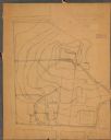
| Date: | 04 1904 |
|---|---|
| Description: | This map is pen and pencil on paper and shows local streets, and the following University of Wisconsin-Madison buildings: the Main Hall, South Hall, North ... |

| Date: | 1918 |
|---|---|
| Description: | This is a collection of two maps. One map is blue line print that includes illustrations and shows the location of buildings, gardens, plant life, and spri... |

| Date: | 1924 |
|---|---|
| Description: | This pictorial map focuses on the Madison Isthmus, Lake Mendota, Lake Monona, Lake Wingra, and shows points of historical interest, buildings, parks, and I... |

| Date: | 1920 |
|---|---|
| Description: | This blue print map and blue line print copy mounted on cloth shows land ownership by name, campus buildings, local streets, railroads, and part of Lake Me... |

| Date: | 1924 |
|---|---|
| Description: | Intended for tourists, this brochure, titled: "Plan Now to See Madison, The Four Lake City: "The City Built on an Isthmus," features a map of Madison and s... |

| Date: | 1921 |
|---|---|
| Description: | This map has labeled streets and points of interest. Lake Mendota and Lake Monona are labeled. The back of the map includes index of University of Wisconsi... |

| Date: | 1929 |
|---|---|
| Description: | This map includes illustrations and shows campus buildings, points of interest in the surrounding area, railroads, Lake Mendota and Lake Monona. The back o... |

| Date: | 1914 |
|---|---|
| Description: | This map shows plat of the town, city limits, numbered blocks and lots, wards, local streets, roads, railroads, Capitol Square, Vilas Park, Edgewood Academ... |

| Date: | 1914 |
|---|---|
| Description: | This map shows a plat of the town, city limits, numbered blocks and lots, wards, local streets, roads, railroads, Capitol Square, Vilas Park, Edgewood Acad... |

| Date: | 1933 |
|---|---|
| Description: | Blue print and blue line print maps that show local streets, Nakoma Country Club, part of Lake Forest, and part of Lake Wingra. A legend is included that s... |

| Date: | 1938 |
|---|---|
| Description: | This map is blue line print and shows local streets, roads, the University of Wisconsin, Monona Village, Verona, Middleton, McFarland, Lake Mendota, Lake M... |

| Date: | 1910 |
|---|---|
| Description: | This maps is pen and pencil on tracing cloth and shows local streets, buildings, proposed and present branches of railroad track, and sewer and water lines... |

| Date: | 1945 |
|---|---|
| Description: | This maps shows roads, railroads, parks, recreational areas, Lake Wingra, Lake Monona, and part of Lake Mendota. The map includes pictorial images that dep... |

| Date: | 1951 |
|---|---|
| Description: | This map shows streets, railroads, Lake Mendota, Lake Monona, Lake Wingra, golf courses, parks, Truax Field, and country clubs. Also included are street, c... |

| Date: | 1953 |
|---|---|
| Description: | This map shows local streets, roads, highways, Middleton, Monona, Lake Wingra, Lake Monona, Lake Mendota, and an inset map that shows city parking areas. A... |
| Date: | 1975 |
|---|---|
| Description: | This bird’s-eye-view map is a series of photographs compiled to show local streets and buildings. |

| Date: | 1956 |
|---|---|
| Description: | This map shows local streets, roads, railroads, highways, parks, cemeteries, hospitals, the University of Wisconsin, Middleton, Maple Bluff, Shorewood Hill... |

| Date: | 1959 |
|---|---|
| Description: | This map shows wards and precincts by number, local streets, roads, parks, Shorewood Hills, Maple Bluff, Middleton, Verona, McFarland, Monona, Truax Field,... |

| Date: | 1960 |
|---|---|
| Description: | This map shows block numbers, tract numbers, tract boundaries, city limits, local streets, railroads, Lake Mendota, and Lake Monona. |

| Date: | 1966 |
|---|---|
| Description: | This map shows streets, highways, railroads, parks, colleges, cemeteries, county clubs, University of Wisconsin, Truax Field, Middleton, Shorewood Hills, M... |
If you didn't find the material you searched for, our Library Reference Staff can help.
Call our reference desk at 608-264-6535 or email us at: