 Filter: Categories of Wisconsin Historical Images
Filter: COLLECTION_NAME of Map Collection
Filter: Creator Name of Unknown
Filter: Categories of Wisconsin Historical Images
Filter: COLLECTION_NAME of Map Collection
Filter: Creator Name of Unknown

| Date: | 04 1945 |
|---|---|
| Description: | Planting plan for Glenwood Children's Park, designed by Jens Jensen. Graphite pencil and colored pencil on tissue (overlays pencil plan) Original drawing... |
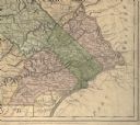
| Date: | 1775 |
|---|---|
| Description: | Detail of Pennsylvania map showing Chester, Philadelphia, and Bucks counties. |

| Date: | 1910 |
|---|---|
| Description: | Left half of a plat map of Hustisford in Dodge County. |

| Date: | 1910 |
|---|---|
| Description: | The right half of a plat map of Hustisford in Dodge County. |

| Date: | 1882 |
|---|---|
| Description: | The official railroad map of Wisconsin showing railroad lines throughout the state. |

| Date: | 1884 |
|---|---|
| Description: | The official railroad map of Wisconsin showing railroad lines throughout the state. |

| Date: | 1867 |
|---|---|
| Description: | A map showing railroad land in Chippewa Valley. |
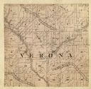
| Date: | 1861 |
|---|---|
| Description: | A map of the Verona Township, which is a section of a larger Dane County map. |

| Date: | 1856 |
|---|---|
| Description: | A Wisconsin map showing the Wisconsin Superior and St. Croix Railroad. |
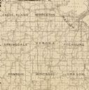
| Date: | 1904 |
|---|---|
| Description: | A map of Verona, which is a detail from a map of Dane County, Wisconsin. |

| Date: | 1911 |
|---|---|
| Description: | A decorative page featuring Dane County public buildings, including a court house, a jail, the poor farm building, and two views of an asylum. |

| Date: | 1911 |
|---|---|
| Description: | A map of the village of Black Earth and Verona. |
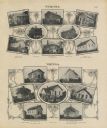
| Date: | 1911 |
|---|---|
| Description: | A decorative page with photographs of school buildings in the township of Verona and Vienna. Some of the photographs have groups of students with their tea... |

| Date: | 1878 |
|---|---|
| Description: | A color map detailing Ashland and Bayfield counties, including Lake Superior and the Apostle Islands. |

| Date: | 1926 |
|---|---|
| Description: | A plat map of the village of Verona in Dane County. |
If you didn't find the material you searched for, our Library Reference Staff can help.
Call our reference desk at 608-264-6535 or email us at:


