 Filter: Categories of Wisconsin Historical Images
Filter: COLLECTION_NAME of Map Collection
Filter: Creator Name of Unknown
Filter: Categories of Wisconsin Historical Images
Filter: COLLECTION_NAME of Map Collection
Filter: Creator Name of Unknown

| Date: | 1940 |
|---|---|
| Description: | This maps shows the areas in Monroe, Jackson, and Juneau counties, Wisconsin, where U.S. Army maneuvers were held in August 1940. Highways and roads, commu... |

| Date: | 1800 |
|---|---|
| Description: | This 19th-century manuscript map of the Town of Newton, Manitowoc County, Wisconsin, shows sections, lakes and streams, the trail from Chicago to Green Bay... |

| Date: | 1926 |
|---|---|
| Description: | This Wisconsin Conservation Commission map from the 1920s shows roads, railroads, campsites, lookout towers, and privately owned lands in Northern Forest S... |

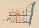
| Date: | 1886 |
|---|---|
| Description: | This map, originally published in the 1881 Illustrated historical atlas of Wisconsin, shows the township and range system, sections,towns, cities and villa... |

| Date: | 1908 |
|---|---|
| Description: | This early 20th century map shows the township and range system, sections, state-owned land, selected buildings and landownership, railroads, bridges, and ... |

| Date: | 1836 |
|---|---|
| Description: | This early to mid-19th century map shows the township and range system, sections, landownership, furnaces, lead mines, copper mines, and roads in the vicin... |

| Date: | 1890 |
|---|---|
| Description: | These hand-colored maps show the sections, lakes, swamps, streams, and state, vacant, entered, and withdrawn lands in ten survey townships in Oneida, Vilas... |

| Date: | 1908 |
|---|---|
| Description: | This 1908 map shows the township and range grid, sections, towns, villages, railroads, bridges, lakes, streams, rapids, and state-owned lands in Oneida Cou... |

| Date: | 1959 |
|---|---|
| Description: | This map identifies public forest land and industrial forest land as of 1959 in Oneida County, Wisconsin, using a 1930 base map showing the township and ra... |

| Date: | 1930 |
|---|---|
| Description: | These 40 hand-drawn maps depict the survey townships in Oneida County, Wisconsin, on printed township grids. Lakes, rivers, and waterfront properties are d... |

| Date: | 1961 |
|---|---|
| Description: | This 1961 map of Ozaukee County, Wisconsin, identifies historic sites and landmarks in the county. Cities and villages, roads, and lakes and streams are al... |

| Date: | 1882 |
|---|---|
| Description: | This manuscript map from 1882 shows land use and land for sale in a portion of the Town of Pewaukee, Waukesha County, Wisconsin. Woods, marshland, springs,... |

| Date: | 1887 |
|---|---|
| Description: | This manuscript map of the southern portion of the Town of Porterfield, Marinette County, Wisconsin, shows sections and land ownership. The Menominee River... |

| Date: | 1830 |
|---|---|
| Description: | This early 19th century manuscript map of Prairie du Chien, Wisconsin, shows sections, landownership and acreages, roads, and ferries in the towns of Bridg... |

| Date: | |
|---|---|
| Description: | This 19th century manuscript map shows lots and acreages in northern Green Bay, Wisconsin, east of the Fox River. "Preble Township, Brown County, Wis." is ... |
| Date: | 1918 |
|---|---|
| Description: | This map shows the property owned by Edwin Bottomley and others at the confluence of Eagle Creek with the Fox River in the Town of Rochester, Racine County... |
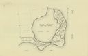
| Date: | |
|---|---|
| Description: | This map shows the lots surrounding Hinton Bay on Round Lake in the Town of Hayward, Sawyer County, Wisconsin. |
| Date: | |
|---|---|
| Description: | This map shows the locations of historic sites and points of interest in Rusk County, Wisconsin. A location key, descriptions of the historical importance ... |

| Date: | 1910 |
|---|---|
| Description: | This early 20th century map shows "choice lake properties owned by Rusk Farm Company, Eau Claire, Wis." on Potato Lake in the Town of Rusk, Rusk County, Wi... |

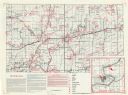
| Date: | 1913 |
|---|---|
| Description: | This early 20th century map of Saint Croix County, Wisconsin, shows the township and range grid, sections, towns, villages, roads, railroads, and lakes and... |
If you didn't find the material you searched for, our Library Reference Staff can help.
Call our reference desk at 608-264-6535 or email us at: