 Filter: Categories of Wisconsin Historical Images
Filter: COLLECTION_NAME of Map Collection
Filter: Creator Name of Unknown
Filter: Categories of Wisconsin Historical Images
Filter: COLLECTION_NAME of Map Collection
Filter: Creator Name of Unknown
| Date: | |
|---|---|
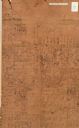
| Description: | Hand-drawn map of the town of Cadiz, Wisconsin near the Illinois border showing plots of landownership. The map also includes one landmark of the Pecatonic... |

| Date: | 1832 |
|---|---|
| Description: | A hand-drawn map showing the survey of Township number 4, Range number 5, West Fourth Principal Meridian, which is parts of the present day towns of Glen H... |

| Date: | |
|---|---|
| Description: | A map of Grant County, Wisconsin showing the locations of townships, towns, cities, villages, roads, railroads, schools, cemeteries, churches, rivers, and ... |

| Date: | 1975 |
|---|---|
| Description: | A tourist map of Grant County that displays the various activities and attractions found in the cities throughout the county, such as boat landings, fishin... |

| Date: | 1955 |
|---|---|
| Description: | Bottom of the map reads: "PARKING AREA STUDY MILWAUKEE COUNTY ZOOLOGICAL GARDEN SCALE 1"=200" APRIL 21, 1955 TOTAL PARKING AREA - 3736 CARS 31.1 acres". Th... |

| Date: | |
|---|---|
| Description: | A hand-colored geological cross section of Iowa County and eastern Dane County, Wisconsin, from the Blue Mounds north-northwest to the sandy plain of the W... |

| Date: | 1935 |
|---|---|
| Description: | Two hand-colored maps of the area comprising the town of Millston (Plats of Townships 20 and 21 north, range 2 west), Jackson County, Wisconsin, showing 40... |

| Date: | |
|---|---|
| Description: | An ink and water color on paper, hand-drawn map showing the section divisions in the southern half of the Janesville Township (Township 3 North, Range 12 E... |

| Date: | 1896 |
|---|---|
| Description: | A hand-colored Map of Jefferson County, Wisconsin, shows township and section divisions, towns, villages and post offices, rural residents, railroads, road... |

| Date: | 1900 |
|---|---|
| Description: | A map of Jefferson County, Wisconsin, that identifies named hills, other points of interest, and the Lake Mills moraine system in the county and identifies... |

| Date: | |
|---|---|
| Description: | A brochure and map of Jefferson County, Wisconsin, that includes illustrations and a location map. Descriptions of points of interest are printed on the op... |

| Date: | |
|---|---|
| Description: | An ink and watercolor on tracing map showing the sections and surveyed lots in the vicinity of the Rock and Crawfish rivers in the central and eastern port... |

| Date: | |
|---|---|
| Description: | An ink and pencil on paper hand-drawn map showing sections and landowners along the north bank of the Fox River in the towns of Grand Chute and Vandenbroek... |

| Date: | 1946 |
|---|---|
| Description: | Map of Kewaunee County, Wisconsin, shows towns, cities and villages, roads and highways, railroads, schools, lighthouses, place names, town divisions, comm... |

| Date: | 1970 |
|---|---|
| Description: | A map of parks of Kewaunee County, Wisconsin, showing the fishing spots, lakes and parks in the area, it also provides a location map of the area. On the ... |

| Date: | 1836 |
|---|---|
| Description: | A series of ink, watercolor, and pencil on paper, hand-drawn maps of the townships of Darlington and Gratiot in Lafayette County, Wisconsin, showing the to... |

| Date: | 1990 |
|---|---|
| Description: | A tourist map of Lafayette County, Wisconsin, that shows the locations of motels, camping, municipal parks, cheese factory tours, waysides, and golf course... |

| Date: | 1909 |
|---|---|
| Description: | A map of Langlade County, Wisconsin that shows townships and ranges, towns, cities and villages, wagon roads, churches, schools, sawmills, town halls, chee... |

| Date: | 1941 |
|---|---|
| Description: | A tourist map of Marinette County, Wisconsin that includes indexes of the lakes and rivers in the county which also identify the fish present, a list of ra... |
If you didn't find the material you searched for, our Library Reference Staff can help.
Call our reference desk at 608-264-6535 or email us at:
