 Filter: Categories of Wisconsin Historical Images
Filter: COLLECTION_NAME of Map Collection
Filter: Creator Name of Unknown
Filter: Categories of Wisconsin Historical Images
Filter: COLLECTION_NAME of Map Collection
Filter: Creator Name of Unknown

| Date: | 1920 |
|---|---|
| Description: | A two-sided map of the state of Wisconsin. The front includes towns and major cities as well as state and county trunk highways. The back includes a smalle... |

| Date: | 1910 |
|---|---|
| Description: | Map of part of the northwestern section of Wisconsin, comprising counties of St. Croix, Dunn, Pierce, and Pepin. Relief shown by hachures. |

| Date: | 1920 |
|---|---|
| Description: | This map identifies the areas of the state that had been geologically surveyed or topographically surveyed, or both, as well as portions of the state still... |

| Date: | 1928 |
|---|---|
| Description: | Map of portions of Wisconsin and Minnesota between Lake Superior and Mississippi River, showing railroads and military road. |

| Date: | 1940 |
|---|---|
| Description: | This map of southeastern Wisconsin depicts the Rock and Milwaukee rivers and the Kettle Moraine area. Cities and villages are identified. Stamp stating "Po... |
| Date: | |
|---|---|
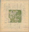
| Description: | This hand-colored map shows the Ranger District boundaryin blue, government lands in green, and "Opt. 9 Appr. Land" in yellow. |

| Date: | 1949 |
|---|---|
| Description: | This color map includes historical descriptions of select areas and a short article on the history of Wisconsin. The major highways in the state shown on t... |

| Date: | 1991 |
|---|---|
| Description: | This canoe guide depicts the Wisconsin River from just north of Prairie du Sac to near Spring Green. Landmarks and points of interest are identified and de... |

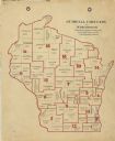
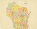
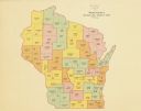
| Date: | 1910 |
|---|---|
| Description: | This early 20th-century map of Wisconsin counties indicates indicate the Wisconsin counties in which there are county historical societies auxiliary to the... |

| Date: | 1935 |
|---|---|
| Description: | This map shows in different colors virgin timberland, second growth timber, pasture belt, crop-pasture belt, intensive crop-pasture belt, intensive pasture... |

| Date: | 1938 |
|---|---|
| Description: | This map shows "regional designation problem areas" and "nature of problem or solution." The left margin has a key showing the problem areas. The right mar... |

| Date: | 1900 |
|---|---|
| Description: | A map of Wisconsin, eastern Minnesota and Iowa, northern Iowa, and Michigan’s Upper Peninsula, showing railway lines, with those marked with heavy red line... |
| Date: | 1900 |
|---|---|
| Description: | A map of Wisconsin showing the seventeen judicial circuits of the state. The map also shows the counties of Wisconsin and the total population of each of t... |
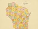
| Date: | 1922 |
|---|---|
| Description: | A map of Wisconsin showing the state’s Assembly Districts. It also provides the population total of each county. |
| Date: | 1922 |
|---|---|
| Description: | A map of Wisconsin showing the state’s congressional districts, it also provides the population total for the state, each district and each county. |
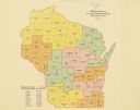
| Date: | 1922 |
|---|---|
| Description: | A map of Wisconsin showing the state’s Senate districts, it also provides the population total for each county. |
| Date: | 1922 |
|---|---|
| Description: | A map of Wisconsin showing the state’s judicial districts, it also provides the population total for each county. |

| Date: | 1912 |
|---|---|
| Description: | A map shows the Presbyterian churches, presbyteries, and districts in Wisconsin, as well as the counties, the locations cities and towns in the state. Indi... |

| Date: | 1856 |
|---|---|
| Description: | A map showing rail lines in Wisconsin and the railroad land grants of the Superior & St. Croix Railroad in the present-day northwestern Wisconsin counties ... |

| Date: | 1890 |
|---|---|
| Description: | A map of Wisconsin, eastern Wisconsin and Iowa, northern Illinois, and the Upper Peninsula of Michigan. The counties, cities and villages, and rail lines i... |
If you didn't find the material you searched for, our Library Reference Staff can help.
Call our reference desk at 608-264-6535 or email us at: