 Filter: Categories of Wisconsin Historical Images
Filter: COLLECTION_NAME of Map Collection
Filter: Creator Name of Unknown
Filter: Categories of Wisconsin Historical Images
Filter: COLLECTION_NAME of Map Collection
Filter: Creator Name of Unknown

| Date: | 1920 |
|---|---|
| Description: | Detail of a map of Dane county showing only Verona. |

| Date: | 1931 |
|---|---|
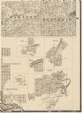
| Description: | An advertisement for H.C. Netherwood Printing Company (formerly) at 519 State Street in Madison, Wisconsin. |
| Date: | 1931 |
|---|---|
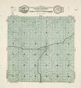
| Description: | A map of the township of Verona, Wisconsin. |

| Date: | 1931 |
|---|---|
| Description: | A map of the village of Verona, Wisconsin. |
| Date: | 1861 |
|---|---|
| Description: | Portion of a map showing Wisconsin villages including Cambria, Fall River, Columbus, Otsego, and Dekorra. |

| Date: | 1847 |
|---|---|
| Description: | A color map of Kentucky with insets showing Lexington, the Falls of Ohio, and the Ohio River. |

| Date: | 1842 |
|---|---|
| Description: | A map of the Western rivers, a "travellers guide" exhibiting the Mississippi, Missouri, Ohio and Illinois Rivers with principal towns. |
| Date: | 1861 |
|---|---|
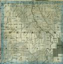
| Description: | A detail from a map of Green County, showing only Decatur. |

| Date: | 1981 |
|---|---|
| Description: | Plat map of Madeline Island surrounded by Basswood, Michigan and Gull Islands. |

| Date: | 1938 |
|---|---|
| Description: | This map shows lakes, rivers, roads, trails, lookout towers, and railroads. |

| Date: | 1941 |
|---|---|
| Description: | Hand-drawn, watercolor and ink, map of Lake Mendota. Locations and many small figures appear around the shore with explanations referring to Indian legends... |

| Date: | 1892 |
|---|---|
| Description: | Topographical map of Madison and surrounding communities which include Lake Mendota, Lake Monona, Lake Waubesa and Lake Kegonsa. The red dots on the map sh... |

| Date: | 1865 |
|---|---|
| Description: | This map of Maryland and Virginia shows railroads, rivers, cities and towns, and the positions of Confederate troops and defenses in Virginia in 1861. |

| Date: | 1857 |
|---|---|
| Description: | This map of Sheboygan Harbor shows the river mouth and harbor, piers, wharfs, piles of old destroyed bridge wharfs, streets, and the lake shore from survey... |
| Date: | 1862 |
|---|---|
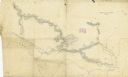
| Description: | A hand-drawn map of the Yazoo River and vicinity. |
If you didn't find the material you searched for, our Library Reference Staff can help.
Call our reference desk at 608-264-6535 or email us at:


