Property Record
279 ESTEY RD (BADGER PARK)
Architecture and History Inventory
| Historic Name: | BADGER PARK |
|---|---|
| Other Name: | BADGER PARK |
| Contributing: | |
| Reference Number: | 74805 |
| Location (Address): | 279 ESTEY RD (BADGER PARK) |
|---|---|
| County: | Lafayette |
| City: | Shullsburg |
| Township/Village: | |
| Unincorporated Community: | |
| Town: | |
| Range: | |
| Direction: | |
| Section: | |
| Quarter Section: | |
| Quarter/Quarter Section: |
| Year Built: | 1934 |
|---|---|
| Additions: | 1935 |
| Survey Date: | 1982 |
| Historic Use: | |
| Architectural Style: | |
| Structural System: | |
| Wall Material: | |
| Architect: | |
| Other Buildings On Site: | |
| Demolished?: | No |
| Demolished Date: |
| National/State Register Listing Name: | Not listed |
|---|---|
| National Register Listing Date: | |
| State Register Listing Date: |
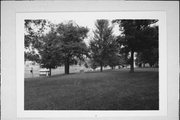
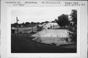
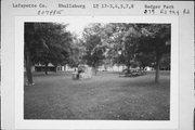
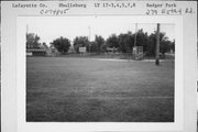
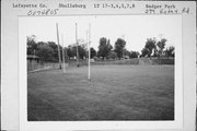
| Additional Information: | A TRIANGULAR SHAPED PIECE OF LAND .2 MI. BY .15 MILE BY .2 MILE THAT HAS BEEN PLANNED TO INCLUDE AN UPPER LEVEL AREA SURROUNDING THE PLAYING FIELD ON THE EAST, THE WEST AND THE SOUTH SIDES. TO THE NORTH ON A LOWER LEVEL IS THE BATH HOUSE AND SWIMMING POOL. THE LANDSCAPE WAS PLANNED AND SUPERVISED BY PHILLIP WYMAN, A LANDSCAPE ARCHITECT FROM MILWAUKEE IN THE 1930'S. THIS PARK HOLDS AN IMPORTANT GEOGRAPHICAL POSTION IN THE VISUAL LANDSCAPE OF THE CITY. BADGER PARK IS AN 8 1/2 ACRE PARK, DEVELOPED IN 1934-1935 AS A WPA PROJECT. INITIAL EFFORTS TO DEVELOP THE PARK WERE LED BY DR. HOESLEY, PHYSICIAN AND MAYOR OF SHULLSBURG. THE 8 1/2 ACRE TRACT WAS PURCHASED BY THE CITY FOR $1,000 FROM FRED HOWL OF JANESVILLE. THE PARK INCLUDES A SWIMMING POOL, BATH HOUSE, SHELTER HOUSES, DOUBLE TENNIS COURTS, CONCESSION STAND, A PICNIC GROUND WITH FIREPLACES, TABLES AND BENCHES, A NATURAL AMPHITHEATER COMMANDING A VIEW OF TWO BASEBALL DIAMONDS AND A FOOTBALL FIELD.(A) DR. HOESLEY APPOINTED A SPECIAL PARK COMMMISSION. MEMBERS WERE: DR. H. A. ENNIS, JOHN MCQUIETY AND DR. J. C. HANIFAN. THE TOPOGRAPHIC SURVEY WAS MADE BY E. E. CLARKE OF PLATTEVILLE.(A) FINAL PLANS WERE DRAWN BY P. WYMAN, A NOTED ARCHITECT FROM MILWAUKEE.(A) AFTER THE DETAILS WERE WORKED OUT, FINAL APPROVAL WAS GIVEN BY THE FEDERAL GOVERNMENT TO START THE PARK AS A WPA PROJECT IN SEPT. 1935.(A) IN 1936, MAYOR HOESLEY AND DR. HANIFAN PROMOTED THE DEVELOPMENT OF AN OLD MINE SHAFT THAT HAD BEEN ABANDONED FOR ALMOST 100 YEARS.(A) THE MINE IS LOCATED ON THE SOUTH END OF THE PARK. THE SHAFTS AND DRIFTS WERE CLEANED OUT. STAIRS WERE BUILT AND ELECTRIC LIGHTS WERE INSTALLED. TOUR GUIDES WERE PROVIDED. SOME YEARS LATER A MUSEUM WAS BUILT NEAR THE MINE SHAFT.(A) |
|---|---|
| Bibliographic References: | A. THE LAFAYETTE COUNTY BICENTENNIAL BOOK, 1977, P. 161. B. DORIS HODGE, DIRECTOR AND TOUR GUIDE OF BADGER MINE AND MUSEUM. C. "SEQ. HISTORY OF SHULLSBURG, 1827-1977," (SHULLSBURG, WI: HISTORICAL SOCIETY, 1977), P. 14. |
| Wisconsin Architecture and History Inventory, State Historic Preservation Office, Wisconsin Historical Society, Madison, Wisconsin |

