Property Record
FOX RIVER AND LAWE ST
Architecture and History Inventory
| Historic Name: | Government Navigation Canal |
|---|---|
| Other Name: | Government Navigation Canal |
| Contributing: | Yes |
| Reference Number: | 73988 |
| Location (Address): | FOX RIVER AND LAWE ST |
|---|---|
| County: | Outagamie |
| City: | Appleton |
| Township/Village: | |
| Unincorporated Community: | |
| Town: | |
| Range: | |
| Direction: | |
| Section: | |
| Quarter Section: | |
| Quarter/Quarter Section: |
| Year Built: | 1850 |
|---|---|
| Additions: | |
| Survey Date: | 1993 |
| Historic Use: | canal |
| Architectural Style: | NA (unknown or not a building) |
| Structural System: | |
| Wall Material: | Stone - Unspecified |
| Architect: | |
| Other Buildings On Site: | |
| Demolished?: | No |
| Demolished Date: |
| National/State Register Listing Name: | Appleton Locks 1--3 Historic District |
|---|---|
| National Register Listing Date: | 12/7/1993 |
| State Register Listing Date: | 4/10/1992 |
| National Register Multiple Property Name: | Waterway Resources of the Lower Fox River |
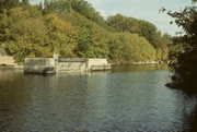
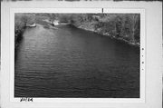
| Additional Information: | A 'site file' titled Appleton Locks 1-3 Historic District exists for this property. It contains additional information such as correspondence, newspaper clippings, or historical information. It is a public record and may be viewed in person at the Wisconsin Historical Society, Division of Historic Preservation-Public History. F in photo code stands for Fox Canal Survey. The approximately 7,000 foot Kaukauna Canal is located within this district. Generally running west Southwest to East Northeast throughout its length, the canal's depth does not exceed six feet. Its width generally varies between 100 and 250 feet, a feature which allows boats to easily pass each other at given points. There are no special embankment features along the canal, which has been dredged periodically throughout its history. It should be noted that a small concrete waste weir is located immediately to the north of Locks #3 and #4, and immediately to the south of Locks #3 and #5. The waste weirs are that portion of the canal that carries water discharged from an upstream lock around the lock(s) immediately below it. Constructed in the 1850s as part of the attempt to develop the Fox and Wisconsin Rivers into a navigable waterway, the Law Street Bridge passes over this canal. |
|---|---|
| Bibliographic References: |
| Wisconsin Architecture and History Inventory, State Historic Preservation Office, Wisconsin Historical Society, Madison, Wisconsin |


