Property Record
4527 E WISCONSIN RD
Architecture and History Inventory
| Historic Name: | |
|---|---|
| Other Name: | Cedars Dam |
| Contributing: | Yes |
| Reference Number: | 52316 |
| Location (Address): | 4527 E WISCONSIN RD |
|---|---|
| County: | Outagamie |
| City: | Little Chute |
| Township/Village: | |
| Unincorporated Community: | |
| Town: | |
| Range: | |
| Direction: | |
| Section: | |
| Quarter Section: | |
| Quarter/Quarter Section: |
| Year Built: | 1934 |
|---|---|
| Additions: | |
| Survey Date: | 1988 |
| Historic Use: | dam/lock |
| Architectural Style: | NA (unknown or not a building) |
| Structural System: | |
| Wall Material: | Concrete |
| Architect: | Orbison and Orbison |
| Other Buildings On Site: | |
| Demolished?: | No |
| Demolished Date: |
| National/State Register Listing Name: | Cedars Lock and Dam Historic District |
|---|---|
| National Register Listing Date: | 12/7/1993 |
| State Register Listing Date: | 4/10/1992 |
| National Register Multiple Property Name: | Waterway Resources of the Lower Fox River |
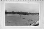
| Additional Information: | A 'site file' titled "Cedars Lock and Dam Historic District" exists for this property. It contains additional information such as correspondence, newspaper clippings, or historical information. It is a public record and may be viewed in person at the Wisconsin Historical Society, Division of Historic Preservation. Actually located just outside of Little Chute in the civil town of Vandenbroek. Photo code: FCS 10/4. This dam is a concrete structure with an overall length of 654 feet. Built in 1933-34, it is located immediately to the south of the lock. The dam creates the pool that floods the canal in which the Cedars Lock is located. It is generally oriented on an NNE/SSW axis, and its south abutment adjoins the Mid-Tec Paper Company power house. Anchored to the river's rock bottom, the dam consists of three sections. The northern section, which is 211 feet, and the southern section, which is 263 feet, are spillways. The spillways are twenty four feet wide, and fix the maximum level of the pool the dam creates at 698.66 feet above sea level (it maintains about a ten foot head). The middle portion of the dam is 180 feet, and contains seven concrete sluiceways, each of which contains a fourteen by twenty foot, steel Tainter gate. The gates are operated by a "crab," a small electrically operated mechanism that moves from gate to gate on a track. The "crab" contains a wench, to which the chain on each end of the gate is attached. As the wench is activated, the chain is taken in or let out, and the height of the gate is adjusted accordingly. A steel catwalk, which facilitates inspections and maintenance, extends the length of the dam. Placed atop the dam is a single story front gabled shed that was erected to shelter the electric "crab." Spanning the abutments adjacent to the northernmost gate, the lift house is reached by the catwalk. It is clad with drop siding, roofed with asphalt shingles, and has walls bounded with pilaster strips. The single window in each side wall and the panelled door at the right of the lockside endwall have simple surrounds. A pair of heavy wooden doors in the opposite endwall swing out to allow passage of the "crab" to which ever gate must be adjusted. The need for a new dam was noted by the Corps of Engineers in 1932 when it observed that the old structure could not adequately discharge flood waters. Construction started in 1933, and was completed in 1934. THIS STRUCTURE IS RELATED TO THE LOCK COMPLEX. |
|---|---|
| Bibliographic References: | (A) Annual Report of the Chief of Engineers, 1932: Extract - Report Upon the Improvement of Rivers and Harbors in the Milwaukee, Wis., District (Washington, D.C.: Government Printing Office, 1933), 1374. (B) Annual Report of the Chief of Engineers, 1933: Extract - Report Upon the Improvement of rivers and Harbors in the Milwaukee, Wis., District (Washington, D.C.: Government Printing Office, 1933), 877. (C) Annual Report of the Chief of Engineers, 1934: Extract - Report Upon the Improvement of Rivers and Harbors in the Milwaukee, Wis., District (Washington, D.C.: Government Printing Office, 1935), 1041. |
| Wisconsin Architecture and History Inventory, State Historic Preservation Office, Wisconsin Historical Society, Madison, Wisconsin |

