Property Record
CHIPPEWA RIVER AT ANDERSON ST
Architecture and History Inventory
| Historic Name: | High Bridge, Chicago, St. Paul, Minneapolis & Omaha Railway |
|---|---|
| Other Name: | Pedestrian Bridge |
| Contributing: | |
| Reference Number: | 40859 |
| Location (Address): | CHIPPEWA RIVER AT ANDERSON ST |
|---|---|
| County: | Eau Claire |
| City: | Eau Claire |
| Township/Village: | |
| Unincorporated Community: | |
| Town: | |
| Range: | |
| Direction: | |
| Section: | |
| Quarter Section: | |
| Quarter/Quarter Section: |
| Year Built: | 1881 |
|---|---|
| Additions: | 1898C. 2007 |
| Survey Date: | 19972015 |
| Historic Use: | bridge |
| Architectural Style: | NA (unknown or not a building) |
| Structural System: | Warren Truss |
| Wall Material: | Metal |
| Architect: | Leighton Bridge and Iron Works; Lassig Bridge and Iron Works |
| Other Buildings On Site: | |
| Demolished?: | No |
| Demolished Date: |
| National/State Register Listing Name: | Chicago, St Paul, Minneapolis, & Omaha Railway Bridge |
|---|---|
| State Register Listing Date: | 5/24/2024 |
| National Register Multiple Property Name: |
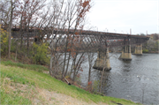
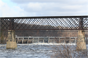
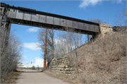
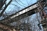
| Additional Information: | A 'site file' exists for this property under the name "Chicago, St. Paul, Minneapolis & Omaha Railway." It contains additional information such as correspondence, newspaper clippings, or historical information. It is a public record and may be viewed in person at the Wisconsin Historical Society, Division of Historic Preservation. Crossing the Chippewa River is this four span lattice truss deck type railroad bridge. Bridge abandoned in 2007 with plans for use as a bicycle/pedestrian trail. 2016- "This six-span bridge is an iron lattice truss structure that spans 900 feet across the Chippewa River. It was constructed by the Chicago, St. Paul, Minneapolis, and Omaha Railway. The bridge is a rare example of this iron lattice deck truss design, of which few examples from the late 19th century remain. The bridge is also an excellent example of an iron bridge, a material that was replaced by steel around 1890. The bridge is commonly known as the High Bridge because its deck is approximately 80 feet above the normal river level. The bridge was abandoned in 1992 and converted into a pedestrian bridge in 2015." -"Eau Claire Landmarks: Designated Historic Properties in Eau Claire, Wisconsin", Eau Claire Landmarks Commission, P.O. Box 5148, 2016. 2021: cracking and settling of the piers was discovered in June 2021, emergency repairs were started in July. The original failing limestone will be replaced with concrete block formed to look like the original limestone piers. |
|---|---|
| Bibliographic References: | A. Another map code for this structure is EC 5P/35 and its corresponding Survey map name is Plat Map #6. |
| Wisconsin Architecture and History Inventory, State Historic Preservation Office, Wisconsin Historical Society, Madison, Wisconsin |


