Property Record
680 Clairville Rd
Architecture and History Inventory
| Historic Name: | |
|---|---|
| Other Name: | |
| Contributing: | |
| Reference Number: | 244950 |
| Location (Address): | 680 Clairville Rd |
|---|---|
| County: | Winnebago |
| City: | |
| Township/Village: | Nekimi |
| Unincorporated Community: | |
| Town: | 17 |
| Range: | 16 |
| Direction: | E |
| Section: | 30 |
| Quarter Section: | SE |
| Quarter/Quarter Section: | NW |
| Year Built: | |
|---|---|
| Additions: | |
| Survey Date: | 2022 |
| Historic Use: | house |
| Architectural Style: | Craftsman |
| Structural System: | |
| Wall Material: | Aluminum/Vinyl Siding |
| Architect: | |
| Other Buildings On Site: | Y |
| Demolished?: | No |
| Demolished Date: |
| National/State Register Listing Name: | Not listed |
|---|---|
| National Register Listing Date: | |
| State Register Listing Date: |
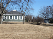
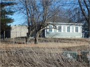
| Additional Information: | 2022: This homestead stands on the east side of Clairville Road, about 0.38 miles south of Cottonwood Ave in Utica Township, Winnebago County. At the time of survey, the property contains two historic-age resources: a house and small outbuilding. Aerial photographs reveal that the house at this former farmstead has been present since at least 1937, but the historic barn was razed sometime after 1975. The square-plan house is one story and set on a stone base. It has a pyramidal roof with a short, raised central cupola. The walls are clad in narrow vinyl lap siding and the windows are modern one-over-one sash with flanking shutters. The small shed is similarly massed with pyramidal roof and square plan and may have historically served as a pumphouse associated with an adjacent historic windmill. Its concrete foundation and modern multi-pane sash windows suggest alterations, if not a modern structure. A modern, flat roof concrete block structure stands behind the house. A large modern garage with a gambrel roof stands on the south end of the property. Historical atlases indicate this property was homesteaded as early as 1889, at which time it stood on a 120-acre parcel owned by JW Morgan in the southeast quarter of Section 30 (Brant & Fuller). Morgan’s estate owned the parcel in 1909 (Daily Northwestern). Research did not uncover biographical information about JW Morgan that would suggest he made significant contributions to history, nor were sufficient associations between Morgan and this property identified. |
|---|---|
| Bibliographic References: | 1878 Map of Winnebago County (Snyder, Van Vechten & Co.) 1889 Illustrated Atlas of Winnebago County (Brant & Fuller) 1909 Map and Plat Book of Winnebago County (Daily Northwestern) |
| Wisconsin Architecture and History Inventory, State Historic Preservation Office, Wisconsin Historical Society, Madison, Wisconsin |


