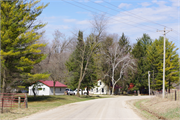
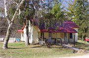
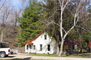
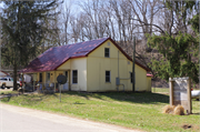
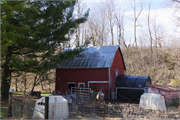
| Additional Information: | 01/2021: The property includes a ca. 1900 side-gabled dwelling (a), a ca. 1910 animal barn (b), a ca. 1945 garage/workshop (c), a ca. 1965 side-gabled shed (d), and a ca. 1950 small gambrel-roof shed (e), along with a number of non-historic-age outbuildings. The one-and-a-half-story, side-gabled dwelling (a) has experienced a number of alterations obscuring its original form and detailing. It features a standing-seam metal roof, apparent standing-seam metal cladding, replacement aluminum windows, a full shed-roof front porch with simple wooden supports, a rear shed-roof addition, and paired replacement vinyl doors on the northeastern façade.
The barn (b) features a metal gambrel roof, standing-seam metal and vertical wood cladding, and a concrete perimeter wall foundation. The primary façade includes a single entrance door, a small wood-framed window, and a bay with hinged double doors. The garage (c) has a metal side-gabled roof, wood cladding, small multi-light wood-framed windows, and two garage bays with replacement overhead garage doors. The side-gabled shed (d) features a standing-seam metal roof, wood cladding, and small aluminum horizontal sash windows. The small gambrel-roof shed (e) has a corrugated metal roof and siding, a small aluminum-framed window, and a single-entry bay.
The dwelling (a) is visible on the 1900 Lancaster quadrangle (USGS 1900). The 1918 Grant County Plat map also depicts a building in the vicinity of the main dwelling (a); however, the owner’s name is not legible (Geo. A. Ogle & Company 1918). The dwelling (a), animal barn (b), garage (c), and small gambrel-roof shed (e) are visible in 1955 historic aerial imagery (NETR 2020). The dwelling (a), animal barn (b), and garage (c) are visible on the 1962 Lancaster quadrangle map (USGS 1962). The side-gabled shed (d) is visible in 1982 aerial imagery (NETR 2020). |
|---|
| Bibliographic References: | Geo. A. Ogle and Company
1918 Standard Atlas of Grant County Wisconsin. Electronic document, http://www.historicmapworks.com/Map/US/29123/Title+Page/Grant+County+1918/Wisconsin/, accessed January 13, 2021.
Grant County GIS Services
2020 Grant County Parcel Viewer. https://gis.co.grant.wi.gov/Parcel_Explorer/, accessed October 6, 2020.
Nationwide Environmental Title Research (NETR)
2020 Historic Aerials Viewer. Electronic document, https://www.historicaerials.com/viewer, accessed
October 6, 2020.
U. S. Geological Survey (USGS)
1900 Lancaster 1: 250, 000 Topographic Quadrangle Map. Reston, VA.
1962 Lancaster 1: 24, 000 Topographic Quadrangle Map. Reston, VA.
Wisconsin Historical Society (WHS)
1986 Cultural Resource Management in Wisconsin: A Manual for Historic Properties, Volumes 1-3.
Historic Preservation Division. State Historical Society of Wisconsin. Copy provided by the
Wisconsin Historical Society. |
|---|

