Property Record
7324 BEE LANE
Architecture and History Inventory
| Historic Name: | |
|---|---|
| Other Name: | |
| Contributing: | |
| Reference Number: | 242793 |
| Location (Address): | 7324 BEE LANE |
|---|---|
| County: | Grant |
| City: | Lancaster |
| Township/Village: | |
| Unincorporated Community: | Beetown |
| Town: | 4 |
| Range: | 4 |
| Direction: | W |
| Section: | 24 |
| Quarter Section: | SE |
| Quarter/Quarter Section: | SE |
| Year Built: | 1920 |
|---|---|
| Additions: | |
| Survey Date: | 2020 |
| Historic Use: | Agricultural - outbuilding |
| Architectural Style: | Other Vernacular |
| Structural System: | Unknown |
| Wall Material: | Wood |
| Architect: | |
| Other Buildings On Site: | Y |
| Demolished?: | No |
| Demolished Date: |
| National/State Register Listing Name: | Not listed |
|---|---|
| National Register Listing Date: | |
| State Register Listing Date: |
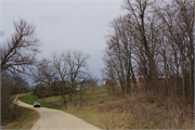
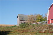
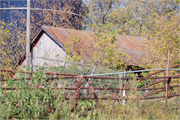
| Additional Information: | 01/2021: The property includes a group of remnant historic-age outbuildings associated with a non-historic-age dwelling, three large non-historic-age barns, and a silo. The resources all date to circa 1920 and include a barn (a), a shed (b), and a corn crib (c) (located directly across the road). The large, side-gabled, open-bay barn (a) features an asphalt-shingled roof of historic age and vertical wood cladding. The side-gabled shed (b) features a corrugated metal roof and vertical wood cladding. No additional details of the shed were discernable from the public ROW due to vegetation. The corn crib (c) on the opposite side of the road features a gabled metal roof, horizontal slat wood siding that is open for ventilation, and a stone foundation. Other details were not discernable from the public ROW. The 1895 Grant County Plat map depicts two resources (presumed dwellings) in the approximate locations of the barn (b) and corn crib (c) (C.M. Foote & Company 1895). The property spanning both sides of the road is identified as Spring Brook Stock & Grain Farm under ownership of C. Brinkman Est. [sic.] (C.M. Foote & Company 1895). The dwellings are still depicted on the Lancaster quadrangle maps in 1900 and 1908 (USGS 1900, 1908). Review of historic aerial imagery indicates the presence of the barn (a), shed (b), and corn crib (c) on site in 1955 (NETR 2020). A non-historic-age dwelling appears on aerial imagery in 1982; the footprint differs from the 1955 aerial (NETR 2020). The barn (a) and shed (b) are both depicted on the 1962 and 1978 Hurricane quadrangle maps (USGS 1962, 1978). |
|---|---|
| Bibliographic References: | C.M. Foote and Company 1895 Plat Book of Grant County Wisconsin. Electronic document, http://www.historicmapworks.com/Atlas/US/8424/Grant+County+1895/, accessed January 13, 2021. Grant County GIS Services 2020 Grant County Parcel Viewer. https://gis.co.grant.wi.gov/Parcel_Explorer/, accessed October 6, 2020. Nationwide Environmental Title Research (NETR) 2020 Historic Aerials Viewer. Electronic document, https://www.historicaerials.com/viewer, accessed October 6, 2020. U. S. Geological Survey (USGS) 1900 Lancaster 1: 250, 000 Topographic Quadrangle Map. Reston, VA. 1908 Lancaster 1: 250, 000 Topographic Quadrangle Map. Reston, VA. 1962 Hurricane 1: 24, 000 Topographic Quadrangle Map. Reston, VA. 1978 Hurricane 1: 24, 000 Topographic Quadrangle Map. Reston, VA. Wisconsin Historical Society (WHS) 1986 Cultural Resource Management in Wisconsin: A Manual for Historic Properties, Volumes 1-3. Historic Preservation Division. State Historical Society of Wisconsin. Copy provided by the Wisconsin Historical Society. |
| Wisconsin Architecture and History Inventory, State Historic Preservation Office, Wisconsin Historical Society, Madison, Wisconsin |

