Property Record
N of W Bruce St between S Muskego Ave and S Menomonee Canal
Architecture and History Inventory
| Historic Name: | Burnham Canal |
|---|---|
| Other Name: | Burnham's Canal |
| Contributing: | |
| Reference Number: | 242233 |
| Location (Address): | N of W Bruce St between S Muskego Ave and S Menomonee Canal |
|---|---|
| County: | Milwaukee |
| City: | Milwaukee |
| Township/Village: | |
| Unincorporated Community: | |
| Town: | |
| Range: | |
| Direction: | |
| Section: | |
| Quarter Section: | |
| Quarter/Quarter Section: |
| Year Built: | 1870 |
|---|---|
| Additions: | |
| Survey Date: | 2020 |
| Historic Use: | canal |
| Architectural Style: | NA (unknown or not a building) |
| Structural System: | |
| Wall Material: | Concrete |
| Architect: | |
| Other Buildings On Site: | |
| Demolished?: | No |
| Demolished Date: |
| National/State Register Listing Name: | Not listed |
|---|---|
| National Register Listing Date: | |
| State Register Listing Date: |
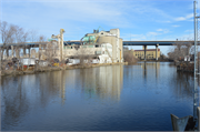
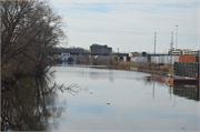
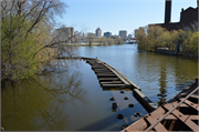
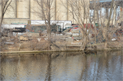
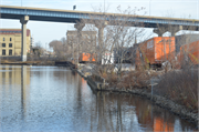
| Additional Information: | A 'site file' exists for this property. It contains additional information such as correspondence, newspaper clippings, or historical information. It is a public record and may be viewed in person at the Wisconsin Historical Society, State Historic Preservation Office. The Burnham Canal was constructed between 1870 and 1872. It measures approximately 0.57 mile in total length and approximately 135 feet in width. The canal is L-shaped in form with the westernmost and longest leg running east-west and terminating just east of S. Muskego Avenue; the shorter leg runs northeast-southwest and terminates at the South Menomonee Canal. The canal is partially banked in concrete with foliage growing along the majority of its length. The Burnham Canal is an open waterway and historically contained no locks or gates as the level landscape of the Menomonee River Valley meant no grade changes and the relatively short length of the canal did not require any aids to navigation. The canal is no longer utilized by motorized vessels as the construction of a fixed-deck bridge over 11th Street in the mid-1980s blocked full navigation of the channel. In 1869, following recommendations made in the Menomonee Valley Improvements Bill, a project to channelize the Menomonee River through a series of canals was begun. During the 1870s, five separate canals were constructed; these included Kneeland’s Canal, Holton’s Canal, the Menomonee Canal, the South Menomonee Canal, and the Burnham Canal (often referred to as “Burnham’s Canal”). Many of these canals were redredged and widened to accommodate an increasing volume of trade and larger shipping vessels in the 1870s and 1880s. A 1922 report on the Port of Milwaukee noted that together, the Burnham Canal and the South Menomonee Canal provided about the same amount of frontage suitable for shipping as the Menomonee River. During this period, coal was a major shipping product along the canals as industry throughout the Menomonee Valley relied on continuous deliveries of this fuel. Since then, the Menomonee Canal, Kneeland’s Canal, Holton’s Canal, and part of the South Menomonee Canal have been filled in leaving the Burnham Canal as the only remaining of the original five canals that has not been filled in or shortened. In 1987, the construction of the existing fixed-deck 11th Street bridge meant that the Burnham Canal would no longer be navigational. |
|---|---|
| Bibliographic References: |
| Wisconsin Architecture and History Inventory, State Historic Preservation Office, Wisconsin Historical Society, Madison, Wisconsin |

