Property Record
39221 SECTION FIVE RD
Architecture and History Inventory
| Historic Name: | |
|---|---|
| Other Name: | |
| Contributing: | |
| Reference Number: | 242155 |
| Location (Address): | 39221 SECTION FIVE RD |
|---|---|
| County: | Ashland |
| City: | |
| Township/Village: | Ashland |
| Unincorporated Community: | |
| Town: | 45 |
| Range: | 3 |
| Direction: | W |
| Section: | 8 |
| Quarter Section: | SW |
| Quarter/Quarter Section: | NE |
| Year Built: | 1955 |
|---|---|
| Additions: | C. 2000 |
| Survey Date: | 2020 |
| Historic Use: | house |
| Architectural Style: | Other Vernacular |
| Structural System: | |
| Wall Material: | Aluminum/Vinyl Siding |
| Architect: | |
| Other Buildings On Site: | Y |
| Demolished?: | No |
| Demolished Date: |
| National/State Register Listing Name: | Not listed |
|---|---|
| National Register Listing Date: | |
| State Register Listing Date: |
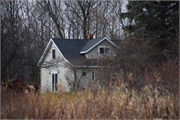
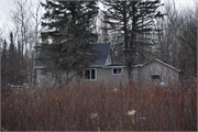
| Additional Information: | September 2020: The resource is south of State Highway 13, and has agricultural fields to the north and east, and a forested area to the south and west. #242155 includes a circa 1955 dwelling, garage, and Quonset hut. The dwelling first appears on a historic aerial photograph from 1965 and a topographic map from 1967 (NETROnline 2020; USGS 1967). The dwelling is a vernacular, side-gabled structure with an asphalt shingle roof and vinyl siding. The one-and-a-half story dwelling has a gabled dormer on its north elevation and an interior, central, on-peak brick chimney. The dwelling features octagonal, sliding, one-over-one, and three-paned picture vinyl windows. It has an enclosed front porch and one circa 2000 addition (GoogleEarth 2020). The addition has a low-pitched roof and forms a hyphen connecting the dwelling to the circa 1955 garage. The garage has been modified from its original use to provide additional living space, and has a concrete masonry unit chimney. Both the addition and garage are clad in the same materials as the dwelling. The Quonset hut could not be seen from the public right-of-way, but can be seen in historic and current aerial imagery (NETROnline 2020, GoogleEarth 2020). The dwelling is in good condition. |
|---|---|
| Bibliographic References: | Ashland County, WI Property Assessor 2020 GIS Viewer. http://ashlandcowi.wgxtreme.com/. Accessed September 20, 2020. GoogleEarth 2020 Aerial Imagery. https://www.google.com/earth/. Accessed September 14, 2020. National Environmental Title Research (NETROnline) 2020 Historic Aerials and Topographic Maps, Wisconsin. https://www.historicaerials.com/viewer. Accessed September 15, 2020. U.S. Geological Survey (USGS) 1967 Marengo, Wisconsin quadrangle map, 15-minute series. USGS, Washington, D.C. |
| Wisconsin Architecture and History Inventory, State Historic Preservation Office, Wisconsin Historical Society, Madison, Wisconsin |


