Property Record
KENOSHA Co.: PARIS TWP SEC. 2, 11. RACINE Co.: YORKVILLE TWP SEC. 1, 11, 12, 14, 23, 26, 35; RAYMOND TWP SEC. 23, 25, 26
Architecture and History Inventory
| Historic Name: | East Branch Root River Canal |
|---|---|
| Other Name: | |
| Contributing: | |
| Reference Number: | 240899 |
| Location (Address): | KENOSHA Co.: PARIS TWP SEC. 2, 11. RACINE Co.: YORKVILLE TWP SEC. 1, 11, 12, 14, 23, 26, 35; RAYMOND TWP SEC. 23, 25, 26 |
|---|---|
| County: | Kenosha |
| City: | |
| Township/Village: | Paris |
| Unincorporated Community: | |
| Town: | 2 |
| Range: | 21 |
| Direction: | E |
| Section: | 11 |
| Quarter Section: | |
| Quarter/Quarter Section: |
| Year Built: | 1935 |
|---|---|
| Additions: | |
| Survey Date: | 2019 |
| Historic Use: | canal |
| Architectural Style: | |
| Structural System: | |
| Wall Material: | |
| Architect: | |
| Other Buildings On Site: | N |
| Demolished?: | No |
| Demolished Date: |
| National/State Register Listing Name: | Not listed |
|---|---|
| National Register Listing Date: | |
| State Register Listing Date: |
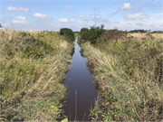
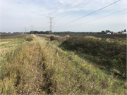
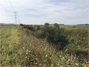
| Additional Information: | The East Branch Root River Canal originates in a swampy, lowlands area in Paris Township in north-central Kenosha County, and flows northward for approximately 13 miles through Yorkville and Raymond Townships in central Racine County. The canal merges with the West Branch Root River Canal at the village of Raymond. From there, the Root River Canal continues north to the headwaters of the Root River in west central Milwaukee and eastern Waukesha counties. The “river flows southeast, picking up contribution from eight sub-watersheds, and ultimately emptying into Lake Michigan in the City of Racine.” Although the river’s headwaters are less than 25 miles north-northwest of its emptying point, its meandering corridor is 43.7 miles long. These waterways are among 117 miles of rivers, streams, and canals; twelve named lakes and ponds; and two dams within the 198-square mile Root River Watershed. The East Branch Root River Canal is the only portion that extends as far south as Kenosha County (WI DNR 2002). The East Branch Root River was a meandering stream before the canal was constructed in the mid-1930s. Historic maps and aerial photos indicate the East Branch Root River Canal was constructed sometime between 1934 and 1937. Plat maps between 1861 and 1934 show the Root River meandering through various portions of sections 2, 3, 11, 14, and 15 of Paris Township. The 1923-32 USGS topographic maps do not depict the river by name or symbol, but a swath of wetlands are indicated there. The 1937 air photo shows the completed canal. The old “stream [had] been ditched and straightened for almost its entire length” (Ruff 1976: 25). The canal corridor originates in section 11 and continues north through section 3 and into Racine County. Air photos and maps show that its path has remained unchanged since it was constructed. The canal is fed water from “several small intermittent tributaries and tile systems draining mostly an agricultural watershed. The bottom is mostly silt and muck and the water is commonly turbid and quite shallow” (Ruff 1976: 25). Europeans began settling in Paris Township in the 1840s, but because of poor drainage and soil conditions, many tracts were left uncultivated. The lands outside the city of Kenosha were called the “grand mire,” and the boggy conditions frequently made traversing by land “forbidding,” especially during winters with deep, drifting snow and “seasons of rain, [routes] became nearly impassible” (Cropley 1949). Railroad corridors were not built through Paris because of the instability of the terrain. The 1850s Kenosha and Rockford Railroad passes through the southern portion of Kenosha County; dairy farming was the “all-important occupation” there, and more supply was needed to meet the demands introduced by railroad trade routes. A 1927 geographical report of southeastern Wisconsin noted that when considering farmland selection, “an outstanding example of retardation in land selection due to bad drainage over a large continuous area is in the town of Paris, Kenosha County.” A “broad belt” of clay loam crosses the township “from north to south [and] makes a pattern which is not, indeed, reproduced on land entries plat.” The report suggested the most beneficial solution was to allow areas of “low wet natural grasslands and wooded swales” to “absorb” excess waters from the “adjacent well-drained lands.” It predicted that once drainage improved in the township, “it will be seen that it was the wet, heavy character of the soils which delayed […] the entry of many tracts in this region” (Schaefer 1927: 111). Poor drainage stunted agricultural development in Paris Township, and its economic growth was further hindered because the instable terrain prevented the construction of railroad corridors through the area. Research indicates the canal was likely built as a part of the Works Progress Administration (WPA), or similar publicly funded building program in the mid-1930s. The US Congress authorized the WPA in 1935 “to create jobs and stimulate the economy.” Wisconsin “participated eagerly in the WPA” and its legislature formed a “state administration as soon as funds became available.” Among the construction projects in the state between 1935 and 1943, crews “created 22,889 miles of roads, erected 1,456 new buildings, laid 1,588 miles of water pipes and sewers, constructed 504 dams, built 17 airports, and planted 63 million trees” (Wisconsin History 2020). River drainage basins were improved statewide. In 1937 it was reported that, “in keeping with the general drainage basin clean-up program being carried out in Wisconsin, all sewered municipalities in the Root, Milwaukee, and Sheboygan River Basins have provided at least primary or tank treatment for their sewage” (US Natural Resources Committee 1937: 45.12). By 1940, the period of railroad development in the region had passed, and following World War II the use of personal vehicles and trucks for trade grew significantly. Local, county, state, and federally funded roads were built throughout the nation. With better-drained, more dependable soil conditions, there was no hesitation to build roads in the area. By the middle of the twentieth century, Paris Township was advantageously bounded on the north by a county highway and on the east by a U.S. highway. The US 41 corridor was originally established in 1926 as a trunk highway. The highway presently runs concurrently with Interstate 94, which was established in 1956 and was completed to its current alignment in 1968. Evaluation The East Branch Root River Canal has a period of significance from its time of construction ca 1935 to 1968 when Interstate 94 was completed, reflecting the end of significant road building programs in the region. The linear resource was considered within the statewide agricultural context, as well as for its significance to the local agricultural economy. While locally significant, the canal is also associated with the federal WPA program. The canal was constructed ca 1935 and was likely built as a public works project. Settlement and agricultural development in the Paris Township were delayed because of the poorly drained soils. The ground conditions also discouraged the construction of railroad corridors through the area, further hindering opportunities for economic growth. Although the East Branch Root River was not used as a shipping corridor, it effectively improved drainage conditions in Paris Township. More land could be cultivated, and soil conditions were better for crops. Roadways were constructed and improved throughout the area following completion of the canal, and farmers trade networks expanded significantly beyond the limits of railroads. Although research did not reveal direct connections between the canal’s construction and WPA activities, there were several other public building and jobs programs at the federal and state level during the Great Depression, all of which carried out important projects. Construction of the East Branch Root River Canal is recommended eligible under Criterion A for its associations with 1930s public works building projects in Wisconsin, as well as for its impact to the local agricultural economy. Research has not identified any individuals or groups of people who were significantly associated with the planning or construction of the canal. Because the canal does not reflect the important achievements of people important to local history, the canal is not eligible under Criterion B. The canal is not significant for its engineering or design. It is not eligible under Criterion C. The canal is recommended eligible for listing in the NRHP for its significance under Criterion A, and its associations with WPA building programs and the local agricultural economy. |
|---|---|
| Bibliographic References: | Cropley, Carrie. "When the Railroads Came to Kenosha." The Wisconsin Magazine of History 33: 2: 188-96 (1949). Retrieved from www.jstor.org/stable/4632118 (1/10/20). Ruff, Jim. “Southeastern Wisconsin River Basins” Drainage Basin Report. State of Wisconsin, Department of Natural Resources, Division of Environmental Standards (1976). Retrieved from https://books.google.com/books/about/Southeastern_Wisconsin_river_basins.html?id=XC9nAAAAMAAJ (1/10/20). Schaefer, Joseph. Four Wisconsin Counties, Prairie and Forest. State historical Society of Wisconsin: Madison (1927). Retrieved from https://archive.org/details/fourwisconsincou00scha/ (1/10/20). United States Natural Resources Committee (USNRC). “Lake Michigan Basin” Drainage Basin Committees' Reports, Volumes 1-22. Water Resources Committee. Retrieved from https://books.google.com/books?id=jD1EAAAAYAAJ&dq (1/10/20). UW-Parkside Archives & Area Research Center. Plat Maps of Racine and Kenosha Counties, 1858-1934. Retrieved from https://archives.uwp.edu/exhibits/show/plat-maps-racine-kenosha/index (1/30/20). Wisconsin Historical Society. “WPA (in Wisconsin)” Historical Essay. Retrieved from https://www.wisconsinhistory.org/Records/Article/CS462 (1/10/20). |
| Wisconsin Architecture and History Inventory, State Historic Preservation Office, Wisconsin Historical Society, Madison, Wisconsin |


