Property Record
MRK TRAIL, 230 M S OF 7 MILE RD
Architecture and History Inventory
| Historic Name: | |
|---|---|
| Other Name: | TMER&L Co. - Pipe culvert |
| Contributing: | |
| Reference Number: | 237208 |
| Location (Address): | MRK TRAIL, 230 M S OF 7 MILE RD |
|---|---|
| County: | Racine |
| City: | Caledonia |
| Township/Village: | |
| Unincorporated Community: | |
| Town: | 4 |
| Range: | 23 |
| Direction: | E |
| Section: | 7 |
| Quarter Section: | NW |
| Quarter/Quarter Section: | NW |
| Year Built: | 2006 |
|---|---|
| Additions: | |
| Survey Date: | 20182024 |
| Historic Use: | |
| Architectural Style: | |
| Structural System: | |
| Wall Material: | Concrete |
| Architect: | |
| Other Buildings On Site: | |
| Demolished?: | No |
| Demolished Date: |
| National/State Register Listing Name: | Not listed |
|---|---|
| National Register Listing Date: | |
| State Register Listing Date: |
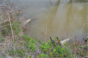
| Additional Information: | Elm Road to Racine Transmission Line Project - Stantec, Inc. This concrete pipe culvert is approximately 160 feet long extending from a point west of the railroad tracks towards the north-northeast, oriented perpendicular to the railroad tracks. This culvert was surveyed in 2018 as part of the “We Energies – TMER&L Co . structures inventory,” in which this culvert is referred to as “We Energies structure #1221”. As of October 2024, this culvert is hidden by vegetation and could not be safely accessed for close inspection. This Union Pacific railroad right-of-way is the former Chicago and North Western Railway right-of-way. The abandoned track of The Milwaukee Electric Railway and Light Company (TMER&L Co) electric train line was parallel to this railroad, but located roughly 1,600 feet to the west, intersecting 7 Mile Road at Douglas Avenue. The abandoned electric train line of the Chicago, North Shore, and Milwaukee Railroad (CNS&M), commonly referred to as the North Shore Line, was also parallel to the Union Pacific tracks and was located a little over 1.5 miles to the west, intersecting 7 Mile Road a short distance to the west of Foley Road. Historic aerial photographs show that this Union Pacific rail bed was significantly narrower in 2005, with only a single-track present. Google Street View images show that the rail bed width was increased to accommodate five parallel tracks at the intersection with 7 Mile Road sometime prior to 2007. This widening of the track bed would have required increasing the length of any culverts present in 2005. |
|---|---|
| Bibliographic References: | Surveyed for WE Energies – TMER&L Co. structures inventory We Energies structure #1221 PAIRED CONCRETE PIPE CULVERT ON THE MILWAUKEE-RACINE-KENOSHA TMER&L CO ROW |
| Wisconsin Architecture and History Inventory, State Historic Preservation Office, Wisconsin Historical Society, Madison, Wisconsin |

