Property Record
4909 7TH ST / COUNTY HIGHWAY A
Architecture and History Inventory
| Historic Name: | Petrifying Springs Park |
|---|---|
| Other Name: | |
| Contributing: | |
| Reference Number: | 220975 |
| Location (Address): | 4909 7TH ST / COUNTY HIGHWAY A |
|---|---|
| County: | Kenosha |
| City: | |
| Township/Village: | Somers |
| Unincorporated Community: | |
| Town: | 2 |
| Range: | 22 |
| Direction: | E |
| Section: | 11 |
| Quarter Section: | |
| Quarter/Quarter Section: |
| Year Built: | 1927 |
|---|---|
| Additions: | 1937 |
| Survey Date: | 2012 |
| Historic Use: | park |
| Architectural Style: | |
| Structural System: | |
| Wall Material: | |
| Architect: | Floyd A. Carlson (park designer); Work Projects Administration (park builder) |
| Other Buildings On Site: | Y |
| Demolished?: | No |
| Demolished Date: |
| National/State Register Listing Name: | Not listed |
|---|---|
| National Register Listing Date: | |
| State Register Listing Date: |
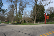
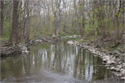
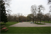
| Additional Information: | A 'site file' titled "Petrifying Springs Park" exists for this property. It contains additional information such as correspondence, newspaper clippings, or historical information. It is a public record and may be viewed in person at the Wisconsin Historical Society, State Historic Preservation Office. 2012- "The park terrain is rolling with steep bluffs that include several springs along the Pike River, which runs along the western and southern portions of the park. Most of the park consists of an eighteen-hole golf course. The golf course features a clubhouse, decorative stone wall and a pair of storage buildings clustered south of CTH A The part of the park that is not golf course largely is wooded and exists along the western and southern portions of the park, as well as a plot of land north of CTH A A road loops through the park, which has three vehicle access points - two on CTH A and one on Petrifying Springs Road/CTH JR. The western and southern stretches of the road generally follow the Pike River- significant portions of the riverbank were rip-rapped in by the WPA. Six parking areas are located along these parts of the roadway. A variety of structural resources such as picnic shelters and comfort stations are clustered around each of these parking areas. WPA-era playground equipment is also found at several of the parking areas. A modern paved recreational trail (2011) runs parallel to the roadway. Four footbridges connect a series of walking trails located on both sides of the Pike River. The park loop road north of CTH A is now closed to vehicular traffic; this portion of the park is heavily wooded and contains no built structures. A maintenance complex is situated in park's northwestern corner. Parking Area #1: Located along a short entrance road that connects Petrifying Springs Road/CTH JR to the park loop road." -"Petrifying Springs Park DOE", Prepared by Michael E. Stevens, SHPO (2012). In 1927, the Commission sought land from Nicholas & George Lichter, Martin & Christian Rasmussen, Fred & George Leet and Joseph Rybor. The parcels combined to form the largest piece of natural, wooded land within the county. The County Board had recently changed its budget system for expenditures and used $79,000 of the resulting surplus to fund the acquisition. The Commission on 27 April 1927 named the new parcel Petrifying Springs Park. Floyd A. Carlson of the City of Kenosha Parks Department created in 1929 a general plan for the park (see Appendix A) which included a park loop trail with parking areas, playgrounds, baseball fields and a lagoon. The plan also provided for bridle trails and an eighteen-hole golf course complete with clubhouse. Petrifying Springs Park in 1930 consisted of 359 acres. Amenities included a baseball field and picnic areas with 110 picnic tables. Two temporary concession stands also operated in the park. With regard to these stands, park officials expressed a strong desire to construct permanent facilities when the budget permitted. Part of the park loop road and a bridge (no longer extant) at the south end of the park had been built – along with three parking areas with a total capacity of 250 cars. The Commission in late 1929 had sought funding to build a golf course and picnic shelters; however, a county budget shortfall in 1930 resulted in those plans being scuttled. In 1932, Kenosha County again budgeted $32,000 for a golf course, but it was never appropriated due to lack of tax revenue during the year. As a result, the Commission stated in its annual report that “it looks now as though it will be some years before funds will be available to build a golf course. It might therefore be advisable for the Board to consider other means to secure a golf course and clubhouse.” New Deal legislation fixed the Park Commission’s budget problem. Kenosha city officials, to include Floyd Carlson, traveled in 1933 to Washington, D.C., to secure federal relief funds for a variety of projects including park development. The delegation was successful and federal assistance from the Federal Emergency Relief Administration (FERA) and, later, the WPA flowed into city and county park projects. Initial projects included in 1933 were a concrete bridge (Bridge #2) that completed the west leg of the park loop road, as well as landscaping. Work on the golf course commenced by FERA/WPA labor in 1934. It was designed by Joseph Roseman. The irrigated golf course required the construction of a six-acre lagoon and pumping station (Fireplace Shelter/Pumphouse). The year 1937 marked the completion of a number of major WPA projects. The 6,150-yard, par 71 golf course opened on 5 June 1937 and over 17,000 people played the course that year. Fees were forty cents per round. It was one of five courses built by the WPA in Wisconsin before 1938. The $50,000 golf course clubhouse was also finished that year. It was designed by Joseph Lindl of the architectural firm of Lindl & Schutte; it included a lounge, dining room, kitchen, showers and locker rooms. Lindl is known as “Kenosha’s leading architect” in the twentieth century. His six-decade career began in 1907 and he designed many prominent buildings in the City of Kenosha and was the primary architect for buildings constructed by Kenosha County. Work conducted in other parts of the park included the completion of a shelter/concession building (no longer extant) along the east leg of the park loop road. A toboggan slide was also built (no longer extant). In 1938, the WPA completed an administration building with greenhouse and an agricultural laboratory building in the maintenance area. The greenhouse and laboratory were advocated for by area truck farmers for agricultural experiments. In 1939, the Kenosha County Board offered the lab to the University of Wisconsin School of Agriculture and it was utilized as an entomology (insect) laboratory and for vegetable research. The programs continued into the 1950s. The Commission reported in 1939 that picnic shelters with fireplaces were built. In 1940, the most significant improvement was adding curbs and pavement to parking areas as well as the park loop road. Other activities were limited to landscaping, adding drain tile and dredging silt from the lagoon. No significant improvements were noted in a 1941 annual report. Kenosha County residents flocked to the park in the late 1930s and early 1940s. Attendance in 1939 was 231,000, of which 25,000 played golf. The ballpark hosted 140 games with 87 being held at night. An estimated 280,000 people utilized the park in 1940 and park officials counted 74,000 cars passing though park entrances. The golf course saw 38,000 people playing a round of golf, which brought in revenues of $13,000. Besides golf and picnicking, visitors also enjoyed 131 baseball games, of which 71 were played at night. Similar statistics marked 1941; however, the number of visitors dropped to 138,000 in 1942 as only 33,000 cars passed through the park. Meanwhile, only 33 baseball games were played while the golf course remained popular with an attendance of 29,000. The park underwent much needed maintenance in 1946. The county repaired footbridges and painted all of the park’s buildings. Landscaping was also a priority. Area residents returned to their county parks in earnest after World War II with total attendance for the entire park system doubling from its 1945 mark. Golf course attendance increased from 25,000 in 1945 to over 37,000. The largest park in the county system, as well as one located between to the cities of Racine and Kenosha, Petrifying Springs most likely accounted for most of the 335,950 people who utilized a Kenosha County park in 1954. Use of the golf course remained steady at nearly 36,000. The park has remained very popular with the residents of Kenosha County, as well as the surrounding areas. Although other parks were later added to the county park system in the 1970s, the location of Petrifying Springs and its diversity of facilities continued to make the park the most visited in the county. --Survey and DOE prepared by Heritage Research, Ltd. (2012). |
|---|---|
| Bibliographic References: | Park Records, Newspapers |
| Wisconsin Architecture and History Inventory, State Historic Preservation Office, Wisconsin Historical Society, Madison, Wisconsin |

