Property Record
W272 S2431 COUNTY HIGHWAY TT / MERRILL HILLS RD
Architecture and History Inventory
| Historic Name: | Jones Family Farmstead / Valley View Farm |
|---|---|
| Other Name: | |
| Contributing: | |
| Reference Number: | 176521 |
| Location (Address): | W272 S2431 COUNTY HIGHWAY TT / MERRILL HILLS RD |
|---|---|
| County: | Waukesha |
| City: | |
| Township/Village: | Waukesha |
| Unincorporated Community: | |
| Town: | 6 |
| Range: | 19 |
| Direction: | E |
| Section: | 7 |
| Quarter Section: | NE |
| Quarter/Quarter Section: | NW |
| Year Built: | 1890 |
|---|---|
| Additions: | |
| Survey Date: | 2011 |
| Historic Use: | house |
| Architectural Style: | Gabled Ell |
| Structural System: | |
| Wall Material: | Asbestos |
| Architect: | |
| Other Buildings On Site: | |
| Demolished?: | No |
| Demolished Date: |
| National/State Register Listing Name: | Not listed |
|---|---|
| National Register Listing Date: | |
| State Register Listing Date: |
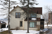
| Additional Information: | See AHI# 176541 for barn. 2011- "The farmstead contains a circa-1890s gabled ell house and five outbuildings. The two-story house rises from a stone foundation and is sheathed with asbestos. An enclosed shed-roof addition is situated in the northeast ell juncture; it carries a modem picture window flanked by five sidelights. The wall above the block addition carries a small pent for a second picture window. A small entry addition is attached to the north facade. The remaining fenestration generally consists of one-over-one, double-hung sashes protected by modem metal combination storm windows. The remainder of the farmstead is centered around a circa-191 Os, gambrel-roof bank bam that features a fieldstone foundation and horizontal board siding. It displays an array of six-light windows and a large metal cupola on the roof ridge. Other outbuildings include a circa-1920s, rusticated concrete block garage; a circa-1950s, concrete stave silo; a circa-1950s concrete block shed; as well as a circa-1920s frame shed. The first illustration of this farm on plat maps occurred in 1891 when it cited D.D. Russell as owning a 118-acre parcel. By 1914, William M. Jones owned the parcel, which was then known as "Valley View Farm." It appeared to stay in the Jones family because J.M. Jones maintained the property in 1930; however, by 1960 it was owned by Henry A. Johnstat. While the farmfields remain undeveloped, the farmstead is not active." -"Waukesha Bypass, CTH TT: STH 59 (south) to I-94 (north)", WisDOT#2788-01-00, Prepared by Heritage Research, Ltd., (2011). |
|---|---|
| Bibliographic References: | Plats. Waukesha Bypass Architecture/History Survey, WisDOT #2788-01-00, Prepared by Heritage Research (2011). |
| Wisconsin Architecture and History Inventory, State Historic Preservation Office, Wisconsin Historical Society, Madison, Wisconsin |

