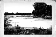
Property Record
BETWEEN FOX AND WISCONSIN RIVERS
Architecture and History Inventory
| Historic Name: | PORTAGE CANAL |
|---|---|
| Other Name: | PORTAGE CANAL (DNR) |
| Contributing: | |
| Reference Number: | 16052 |
| Location (Address): | BETWEEN FOX AND WISCONSIN RIVERS |
|---|---|
| County: | Columbia |
| City: | Portage |
| Township/Village: | |
| Unincorporated Community: | |
| Town: | |
| Range: | |
| Direction: | |
| Section: | |
| Quarter Section: | |
| Quarter/Quarter Section: |
| Year Built: | 1835 |
|---|---|
| Additions: | 1876 1851 |
| Survey Date: | 1990 |
| Historic Use: | canal |
| Architectural Style: | NA (unknown or not a building) |
| Structural System: | |
| Wall Material: | Wood |
| Architect: | Conro, Strke and Co. |
| Other Buildings On Site: | |
| Demolished?: | No |
| Demolished Date: |
| National/State Register Listing Name: | Portage Canal |
|---|---|
| National Register Listing Date: | 8/26/1977 |
| State Register Listing Date: | 1/1/1989 |
| National Register Multiple Property Name: |
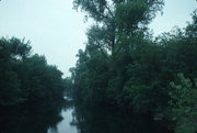
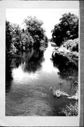
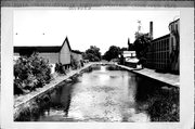
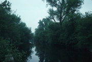
| Additional Information: | A 'site file' exists for this property. It contains additional information such as correspondence, newspaper clippings, or historical information. It is a public record and may be viewed in person at the Wisconsin Historical Society, Division of Historic Preservation. ADDITIONAL PHOTO CODES ARE FCS 15/1 THRU 15. ADDITIONAL MAP AND MAP CODE IS DOT PORTAGE FCS 15/1-15. Two mile long canal constructed to provide a continuous water route from the Great Lakes to the Gulf of Mexico. Never met its lofty expectations but did handle steamer traffic for a short period of time. "At high water, the Wisconsin River seasonally flowed across the portage, now the city's first Ward, into the Fox which sits eight feet lower than the Wisconsin. This seasonal frequency of a navigable channel between the rivers gave rise to the first formal attempt on paper to create a permanent waterway in 1829. In 1839, the U.S. War Dept. sent Capt. J.T. Cram to determine where locks and dams should be located and to estimate the engineering costs of a continuous waterway between the Mississippi and Lake Michigan. First steps required a canal at The Portage and dams with locks along the Upper Fox River to break the 39 foot drop between Portage and Lake Winnebago. A previous attempt at a canal at in 1835 was made parallel to what is now Wauona Trail, a National Register Site. This is also where Capt. Cram's 1839 engineering records place it. The canal was dug at its current location initially from 1849-51. It functioned successfully for shallow draft steamboats and barges from from the 1850s onward. "Before 1876 [when the canal was dredged and rebuilt] there was just a tow path. They used to pull boats through the canal with a team of horses. There was a driveway close to the [south] side of the canal. Our house was close to the canal and there was just road enough so a team could go through there." After the Civil War the canal franchise was transferred to the federal government. It was then improved by the U.S. Army Corps of Engineers in 1874 & '76 to accommodate deer draft steamboats. It was later discovered that the faster steamboats with deep drafts could not navigate the Wisconsin River to reach the canal. The Army Corps built a series of wing dams in the Wisconsin to create the needed navigation channel, only to find they rapidly silted over thus defeating navigation by 1886 along the Wisconsin River. However, the canal continued to operate successfully for another 60 years. The canal was at its peak for recreational boat traffic in 1908 with 2,461 lockages at the Fort Winnebago Lock, going into the Fox, and 127 lockages at the Portage Lock opening to the Wisconsin. By 1950, Ft. Winnebago lockages had dwindled to 31, with 8 at the Portage Lock. The Upper Fox System was closed to commercial navigation in 1951 and recreational boating continued at a much reduced level. After a century of operation The Canal was victim not only to devastating floods but to the success of the railroads and unnavigability of the Wisconsin with its shifting sands." Historic Portage, WI: Downtown & Waterfront Walking Tour, 1995. Shared used bridge added 2020 in cooperation with WHS, City of Portage, Canal Ad Hoc Committee, and the National Park Service. |
|---|---|
| Bibliographic References: | BARABOO NEWS REPUBLIC 2/10/1995. PORTAGE DAILY REGISTER 2/21/1995. WISCONSIN STATE JOURNAL 2/18/1995. PORTAGE DAILY REGISTER 2/20/1995. BARABOO NEWS REPUBLIC 5/18/1995. PORTAGE DAILY REGISTER 5/17/1995. BARABOO NEWS REPUBLIC 5/19/1995. PORTAGE DAILY REGISTER 5/3/1995. PORTAGE DAILY REGISTER 9/26/1995. Portage Daily Register 10/8/1997. Portage Daily Register 4/13/2000. Historic Portage, WI: Downtown & Waterfront Walking Tour, 1995. |
| Wisconsin Architecture and History Inventory, State Historic Preservation Office, Wisconsin Historical Society, Madison, Wisconsin |

