Property Record
500 E VETERANS ST
Architecture and History Inventory
| Historic Name: | Tomah Indian School Hospital |
|---|---|
| Other Name: | VA Medical Center-Building #2 |
| Contributing: | |
| Reference Number: | 117826 |
| Location (Address): | 500 E VETERANS ST |
|---|---|
| County: | Monroe |
| City: | Tomah |
| Township/Village: | |
| Unincorporated Community: | |
| Town: | |
| Range: | |
| Direction: | |
| Section: | |
| Quarter Section: | |
| Quarter/Quarter Section: |
| Year Built: | 1932 |
|---|---|
| Additions: | |
| Survey Date: | 1999 |
| Historic Use: | hospital/medical clinic |
| Architectural Style: | Colonial Revival/Georgian Revival |
| Structural System: | |
| Wall Material: | Brick |
| Architect: | |
| Other Buildings On Site: | |
| Demolished?: | No |
| Demolished Date: |
| National/State Register Listing Name: | Not listed |
|---|---|
| National Register Listing Date: | |
| State Register Listing Date: |
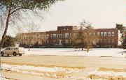
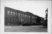
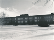
| Additional Information: | A 'site file' exists for this property. It contains additional information such as correspondence, newspaper clippings, or historical information. It is a public record and may be viewed in person at the Wisconsin Historical Society, Division of Historic Preservation. 2000 - The VA Administration Medical Center is comprised of 8 Georgian Revival style hospital buildings built in 1946-47. Some administrative and support structures arrayed in a campus-like setting, complete the facility. Prior to the property's use by the VA Administration (beginning in 1891) it was used as the location of the Tomah Indian School. Some buildings associated with the Indian School remain on the grounds and are now associated with the hospital complex. August/September 1999-The Tomah Veteran's Administration Medical Center is comprised of eight Georgian Revival style hospital buildings constructed in 1946-1947 and a dining hall built in 1959, as well as various support and administrative buildings arranged in a campus setting. Some of the buildings of the Indian school established in 1891 remain on the grounds and have been incorporated into the Veterans Hospital. The boundary of the Veteran's Administration Medical Center Historic District commences at the intersection of CTH ET and 5th Street, then continues north along 5th to its intersection with E Street, then continuing around the circular drive as follows: east along E Street, then north along 6th Street, then along the rear drive (G Street) north of the hospital buildings, then south along 3rd Street to point in direct line with the rear of the greenhouse (Bldg. #423). The boundary then continues west along the rear of the greenhouse and rear of the boiler house (Bldg. #415) to 1st Street, then south along the parking lot and driveway to 2nd Street, then continuing east across 2nd Street to the driveway leading to 3rd Street, then continuing east across 3rd Street to the driveway between the Manual Arts Building (Bldg. #32) and the Nursing Care Unit (Bldg. #402), then continuing east to the enclosed walk or tramway, then continuing south along the enclosed walk to the north side of E. Street, then continuing east along the north side of E. Street to its intersection with 4th Street, then south along the east side of 4th Street to its intersection with CTH ET, then continuing east along the north side of CTH ET to the point of beginning. The boundary of the Tomah Indian School Historic District commences at the intersection of CTH ET and Glendale Avenue, then proceeding south along Glendale Avenue to a point in a direct line with the rear of the south well and pump house, then continuing west along the rear of Building #10 and #212 and the children's playground, then continuing west along the rear of the parking lot fronting on B Street, then continuing west to the rear of the pump house to 2nd Street to its intersection with CTH ET, then continuing north across along the west side of Building #6 to the rear of Buildings #40 and #36 to the south boundary line of the Veteran's Administration Medical Center Historic District, then east along the southern boundary of the VA Medical Center Historic District to the enclosed walk, then continuing south along the enclosed walk to E. Street, then continuing east along the southern boundary of the Medical Center Historic District on E. Street to the intersection of E. Street and 4th Street, then south along the west side of 4th Street to its intersection with CTH ET, then west along CTH ET to the point of beginning. |
|---|---|
| Bibliographic References: | WiDOT project #7998-00-40 survey report, prepared by Archaeological Research Inc. - Madison, WI. WHS compliance project #01-0146/MO. |
| Wisconsin Architecture and History Inventory, State Historic Preservation Office, Wisconsin Historical Society, Madison, Wisconsin |


