Photograph
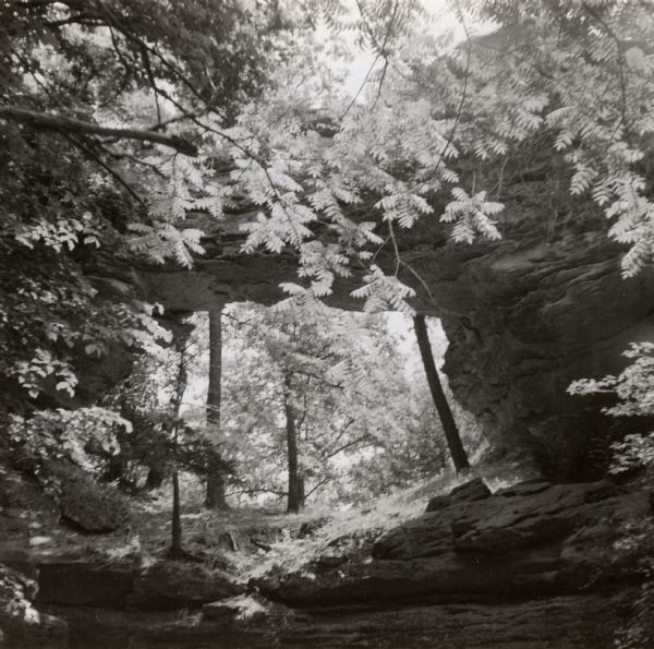
Raddatz Rockshelter and Natural Bridge

| Raddatz Rockshelter and Natural Bridge, known by archaeologists as 47 SK-5. The bridge is made of sand stone, reaching 35 feet in height, and is the largest natural bridge in the state. The shelter is the oldest documented site of primitive man in the upper-Midwest, where soot from the campfires of the earliest inhabitants - 10,000 to 12,000 years ago - is still visible on the soft sandstone walls. This site was named after the Raddatz family (from Germany), owners of the land beginning in the early 1900s. The natural bridge has been a tourist attraction for visitors since 1870, and was excavated in 1955 and 1957 by Warren Wittry for the State Historical Society of Wisconsin. Animal remains found at the site to-date include 15 species of mollusks, and 50 vertebrate species including remains of passenger pigeon, turkey, elk, wolf, bobcat, fisher, marten and mountain lion. Natural Bridge State Park was established in 1972, and the following year 60 acres centered on the arch were given a further level of protection as Natural Bridge and Rockshelter State Natural Area. The park encompasses about 530 acres, including a 60-acre scientific area. A self-guided nature trail explains the many ways native plants were used throughout history by Native Americans and early European settlers. A two mile hiking trail passes through the woods to the Bridge. In 1978 the site was added to the National Register of Historic Places (Site #78000139). Location: Sauk County, Honey Creek Township, one mile northeast of Leland off County C. Latitude: 43.3483201 Longitude: -89.9312354 |
| Image ID: | 36901 |
|---|---|
| Creation Date: | 1954 |
| Creator Name: | Wittry, Warren |
| City: | Leland |
| County: | Sauk |
| State: | Wisconsin |
| Collection Name: | Wisconsin place file, circa 1850s-circa 1950s |
| Genre: | Photograph |
| Original Format Type: | photographic print, b&w |
| Original Format Number: | PF Leland.2 |
| Original Dimensions: | 4.5 x 4.5 inches |
| Previously misidentified as the Durst Site. |
| Trees |
| Dwellings |
| Outdoor photography |
| Landforms |
| Archaeological site location |
| Formations (Geology) |
| This image is issued by the Wisconsin Historical Society. Use of the image requires written permission from the staff of the Collections Division. It may not be sold or redistributed, copied or distributed as a photograph, electronic file, or any other media. The image should not be significantly altered through conventional or electronic means. Images altered beyond standard cropping and resizing require further negotiation with a staff member. The user is responsible for all issues of copyright. Please Credit: Wisconsin Historical Society. |
| Location: | Wisconsin Historical Society Archives, 4th Floor, Madison, Wisconsin |
|---|
