Postcard
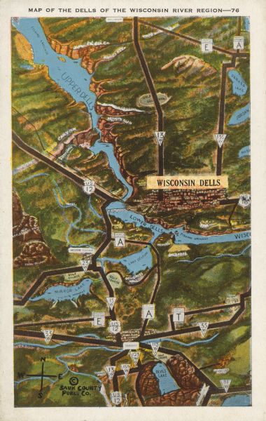
Map of the Dells of the Wisconsin River Region

| Text on front reads: "Map of the Dells of the Wisconsin River Region." On reverse: "All the world knows of the Wisconsin Dells. Many noted travelers have proclaimed it one of America's greatest attractions. There is nothing like it in America and it stands by itself as different from all other of nature's beauty spots." An illustrated map of the Wisconsin Dells region from Devil's Lake in the south to the upper Dells in the North. The communities, roads, terrain and many attractions are labeled. |
| Image ID: | 151445 |
|---|---|
| Creation Date: | after 1931 |
| Creator Name: | E.C. Kropp Co. |
| City: | Wisconsin Dells |
| County: | Columbia |
| State: | Wisconsin |
| Collection Name: | Wisconsin postcard collection, circa 1860s?-circa 1990s |
| Genre: | Postcard |
| Original Format Type: | prints, photomechanical |
| Original Format Number: | PH 2744 |
| Original Dimensions: | 3.5 x 5.5 inches |
| Divided back. 1¢ stamp. #76. #11625. ©Sauk County Publ. Co. |
| Painting |
| Cities and towns |
| Forests and forestry |
| Formations (Geology) |
| Tourism |
| Roads |
| Lakes |
| Rivers |
| Wisconsin River (Wis.) |
| Maps |
| This image is issued by the Wisconsin Historical Society. Use of the image requires written permission from the staff of the Collections Division. It may not be sold or redistributed, copied or distributed as a photograph, electronic file, or any other media. The image should not be significantly altered through conventional or electronic means. Images altered beyond standard cropping and resizing require further negotiation with a staff member. The user is responsible for all issues of copyright. Please Credit: Wisconsin Historical Society. |
| Location: | Wisconsin Historical Society Archives, 4th Floor, Madison, Wisconsin |
|---|
