Map or Atlas
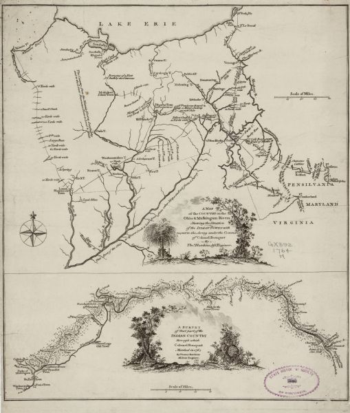
A Map of the Country on the Ohio & Muskingum Rivers Shewing the Situation of the Indian Towns with Respect to the Army under the Command of Colonel Bouquet

| Map of the region south of Lake Erie to the Ohio River. It shows forts, towns, Native American towns, mines, roads, mountains, swamps, lakes, and rivers. The width of the rivers are recorded, and numerous annotations describe the land, whether it is level, contain ridges, or swampy. Crossed swords mark the location of battles, and an 'x' marks the remains of an Ottawa fort. An inset map below the main map shows the march of Colonel Bouquet and the location of his encampments. Trees decorate both title cartouches. |
| Image ID: | 124811 |
|---|---|
| Creation Date: | circa 1766 |
| Creator Name: | Hutchins, Thomas |
| City: | |
| County: | |
| State: | |
| Collection Name: | Map Collection |
| Genre: | Map or Atlas |
| Original Format Type: | prints, photomechanical |
| Original Format Number: | H GX892 1764 H |
| Original Dimensions: | 37 x 31 cm |
| Mines and mineral resources |
| Military bases |
| Battles |
| Marshes |
| Mountains |
| Engraving |
| Trees |
| Military camps |
| Roads |
| Cities and towns |
| Lakes |
| Rivers |
| This image is issued by the Wisconsin Historical Society. Use of the image requires written permission from the staff of the Collections Division. It may not be sold or redistributed, copied or distributed as a photograph, electronic file, or any other media. The image should not be significantly altered through conventional or electronic means. Images altered beyond standard cropping and resizing require further negotiation with a staff member. The user is responsible for all issues of copyright. Please Credit: Wisconsin Historical Society. |
| Location: | Wisconsin Historical Society Archives, 4th Floor, Madison, Wisconsin |
|---|
