Map or Atlas
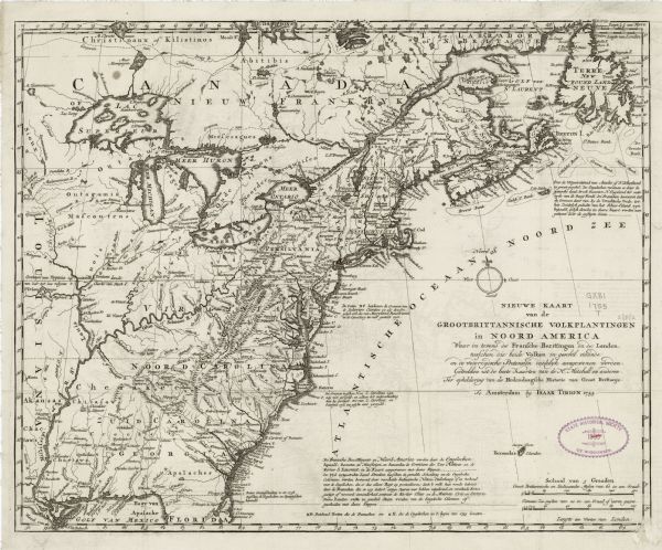
Nieuwe Kaart van de Grootbrittannische Volkplantingen in Noord America waar in Tevens de Fransche Bezittingen en de Landen, Tusschen die Beide Volken in Geschil Staande en de Wederzydsche Pretensien Duidelyk Aangewezen Worden

| Dutch map of America and parts of Canada east of the Mississippi based largely on the famous John Mitchell map. It shows rivers, lakes, mountains, settlements, cities, Native American land, forts, and the boundaries between European claims. British claims are extended west to the Mississippi as they are in the Mitchell map. Numerous notes appear throughout the map, explaining the borders and the history of the British in North America. Faint off setting is apparent on this copy; a common printers mistake when a map is folded or placed on another before the ink is fully dry. |
| Image ID: | 123902 |
|---|---|
| Creation Date: | 1755 |
| Creator Name: | Tirion, Isaak |
| City: | |
| County: | |
| State: | |
| Collection Name: | Map Collection |
| Genre: | Map or Atlas |
| Original Format Type: | prints, fine-art |
| Original Format Number: | H GX81 1755 T |
| Original Dimensions: | 36 x 46 cm., on sheet 40 x 48 cm |
| Engraving |
| Cities and towns |
| Maps |
| Mountains |
| International relations |
| Lakes |
| Mississippi River |
| Rivers |
| This image is issued by the Wisconsin Historical Society. Use of the image requires written permission from the staff of the Collections Division. It may not be sold or redistributed, copied or distributed as a photograph, electronic file, or any other media. The image should not be significantly altered through conventional or electronic means. Images altered beyond standard cropping and resizing require further negotiation with a staff member. The user is responsible for all issues of copyright. Please Credit: Wisconsin Historical Society. |
| Location: | Wisconsin Historical Society Archives, 4th Floor, Madison, Wisconsin |
|---|
