Map or Atlas
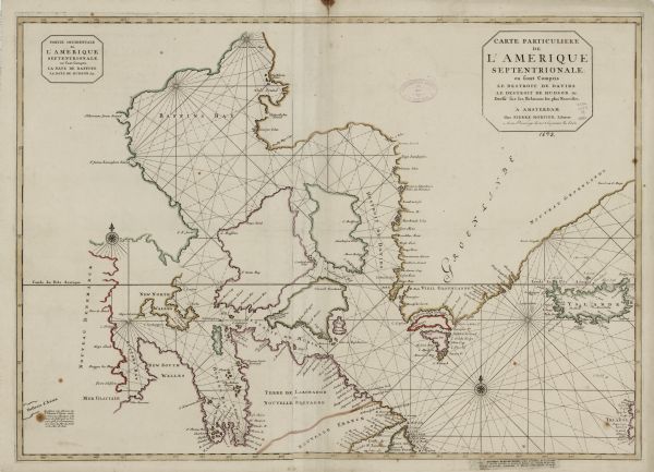
Carte Particuliere de l'Amerique Septentrionale: Ou sont Compris le Destriot de Davids, le Destroit de Hudson, &c.: Dressé sur les Relations les plus Nouvelles

| A sea chart of Hudson's Bay, Greenland, and the Canadian Arctic. This map shows rhumb lines extending from various points including two compass roses. Coastal features and a few towns and forts are labeled, but much of the land masses remain bare. Mortier shows the 'Mer Glaciale' (Sea of Ice) at the bottom of Button's Bay as potentially connecting to the mythical channel 'Detroit d'Anian,' which was hoped to link the Atlantic and Pacific Oceans. |
| Image ID: | 123391 |
|---|---|
| Creation Date: | circa 1698 |
| Creator Name: | Mortier, Pierre |
| City: | |
| County: | |
| State: | |
| Collection Name: | Map Collection |
| Genre: | Map or Atlas |
| Original Format Type: | prints, fine-art |
| Original Format Number: | D GX82 1693 .M |
| Original Dimensions: | 57 x 81 cm, on sheet 63 x 96 cm |
| Appeared as part of Pierre Mortier’s magnificent sea atlas, Suite de Neptune Francois ou Atlas Nouveau des Cartes Marines (Amsterdam, circa 1696). |
| Engraving |
| Cities and towns |
| Maps |
| Coasts |
| Aids to navigation |
| Bays |
| Lakes |
| Rivers |
| This image is issued by the Wisconsin Historical Society. Use of the image requires written permission from the staff of the Collections Division. It may not be sold or redistributed, copied or distributed as a photograph, electronic file, or any other media. The image should not be significantly altered through conventional or electronic means. Images altered beyond standard cropping and resizing require further negotiation with a staff member. The user is responsible for all issues of copyright. Please Credit: Wisconsin Historical Society. |
| Location: | Wisconsin Historical Society Archives, 4th Floor, Madison, Wisconsin |
|---|
