Map or Atlas
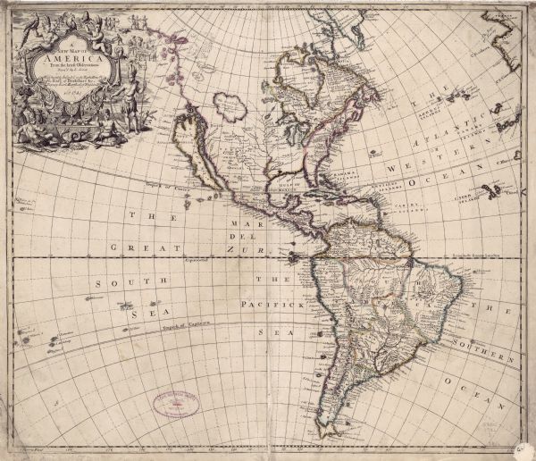
A New Map of America from the Latest Observations

| A map of North and South America with an elaborately illustrated cartouche depicting Native Americans in upper left corner. The map is fairly detailed, depicting cities, lakes, rivers, regions, and countries. A few interesting features makes this map fairly unique, particularly for its time. The shape of South America as shown in this map is unusual, and Senex includes two mythical geological features in North America: a large lake called Lake Thoaga in western Canada, and an unnamed river rising up through the Florida panhandle. Also of note, this is one of the few maps for its time to still show California as an island, and to still depict a conjectural Northwest coastline. |
| Image ID: | 123105 |
|---|---|
| Creation Date: | 1721 |
| Creator Name: | Senex, John |
| City: | |
| County: | |
| State: | |
| Collection Name: | Map Collection |
| Genre: | Map or Atlas |
| Original Format Type: | prints, fine-art |
| Original Format Number: | D GX80 1721 S |
| Original Dimensions: | 49 x 58 cm |
| Copy two has a watermark of a Fleur de Lis. |
| Ocean |
| Rivers |
| Lakes |
| Maps |
| Engraving |
| Cities and towns |
| This image is issued by the Wisconsin Historical Society. Use of the image requires written permission from the staff of the Collections Division. It may not be sold or redistributed, copied or distributed as a photograph, electronic file, or any other media. The image should not be significantly altered through conventional or electronic means. Images altered beyond standard cropping and resizing require further negotiation with a staff member. The user is responsible for all issues of copyright. Please Credit: Wisconsin Historical Society. |
| Location: | Wisconsin Historical Society Archives, 4th Floor, Madison, Wisconsin |
|---|
