Map or Atlas
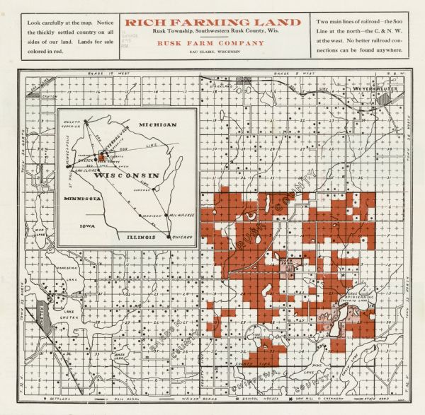
Rich Farming Land, Rusk Township, Southwestern Rusk County, Wis.

| This map shows land for sale by the Rusk Farm Company. Caption reads, "Look carefully at the map. Notice the thickly settled country on all sides of our land. Lands for sale colored in red. Two main lines of railroad--the Soo Line at the north-- the C & N. W. at the west. No better railroad connections can be found anywhere." Shows the location of the company's demonstration farm, settlers, railroads, wagon and state roads, school houses, saw mills, and creameries. Also covers parts of adjacent townships in Rusk, Barron, and Chippewa Counties. An inset maps show the location of the land in relation to the entire state of Wisconsin and railroad connections. The back of the map includes text and illustrations to promote the purchase of the farm land. |
| Image ID: | 120818 |
|---|---|
| Creation Date: | circa 1912 |
| Creator Name: | Rich farming land, Rusk Township, southwestern Rusk County, Wis. |
| City: | Rusk |
| County: | Rusk |
| State: | Wisconsin |
| Collection Name: | Map Collection |
| Genre: | Map or Atlas |
| Original Format Type: | prints, photomechanical |
| Original Format Number: | H GX9028 R95 RU |
| Original Dimensions: | 25 x 29 cm, on sheet 31 x 32 cm |
| Farmhouses |
| Schools |
| Sawmills |
| Farms |
| Railroads |
| Roads |
| Wagons |
| Land companies |
| This image is issued by the Wisconsin Historical Society. Use of the image requires written permission from the staff of the Collections Division. It may not be sold or redistributed, copied or distributed as a photograph, electronic file, or any other media. The image should not be significantly altered through conventional or electronic means. Images altered beyond standard cropping and resizing require further negotiation with a staff member. The user is responsible for all issues of copyright. Please Credit: Wisconsin Historical Society. |
| Location: | Wisconsin Historical Society Archives, 4th Floor, Madison, Wisconsin |
|---|
