

Maps & Atlases


Take A Look Inside
Maps & Atlases
The Society owns more than 25,000 maps and atlases. The majority focus on Wisconsin, the Midwest, the United States and Canada.
Explore Digital Maps & Atlases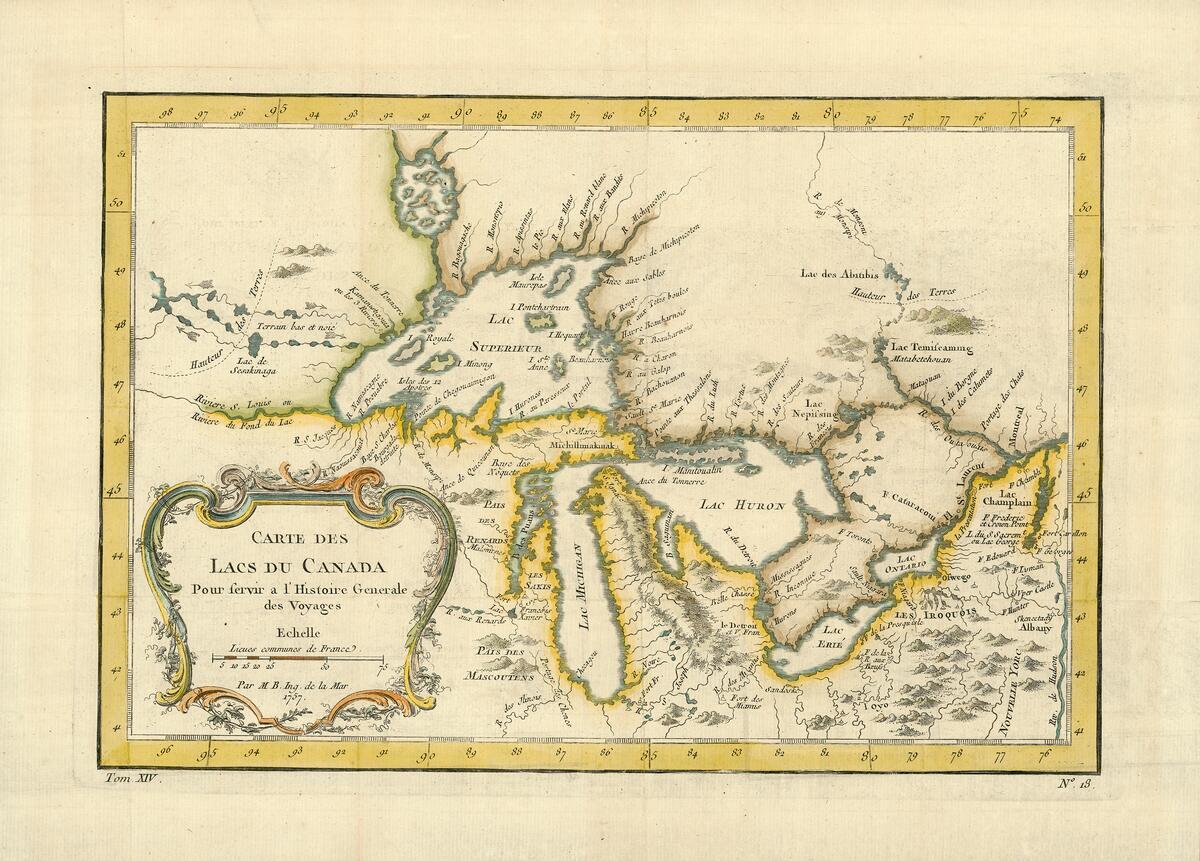
Carte des lacs du Canada
Jacques Nicolas Bellin, an 18th-century French hydrographer, transformed the field of cartography by prioritizing accuracy over ornamentation. This is a 1764 edition of his map of the Great Lakes region, which was later used to draw the post-Revolutionary War border between the United States and Canada. His 1744 edition, based on the travel journal of Pierre François Xavier de Charlevoix, was the first to show the imaginary islands of Philippeaux and Pontchartrain in Lake Superior—an error that would be copied by other cartographers and a cautionary tale that even careful research can by effected by inaccurate sources.
"Carte des lacs du Canada, pour servir à l’Histoire générale des voyages"
This map is mounted on cloth and shows streets, railways, and city wards. The scale is indicated by half mile circles from the Langlois Company. A stamp in the right margin reads: "The Library of Congress, one copy received Feb. 29, 1904 ..." ID:W0142MI
About the Collections
Our historic maps of Wisconsin and the World date from as early as 1513.
Maps are invaluable resources for researching the history of North American exploration, economic and social development, environmental change, local history and genealogy. The Wisconsin Historical Society has a comprehensive collection of Wisconsin plat maps, historical atlases, and bird’s eye views. The collections do not include any GPS datasets or aerial photos.
The Wisconsin Historical Society owns more than 25,000 maps and atlases. The majority focus on Wisconsin, the Midwest, the United States and Canada. About 80 percent predate 1900. Examples of nearly every type of traditional cartographic medium can be found — from elaborate maps of Renaissance explorations to simple outline maps.
Maps & Atlases Collections
Plat Maps & Plat Books of Wisconsin

Plat Maps & Plat Books of Wisconsin
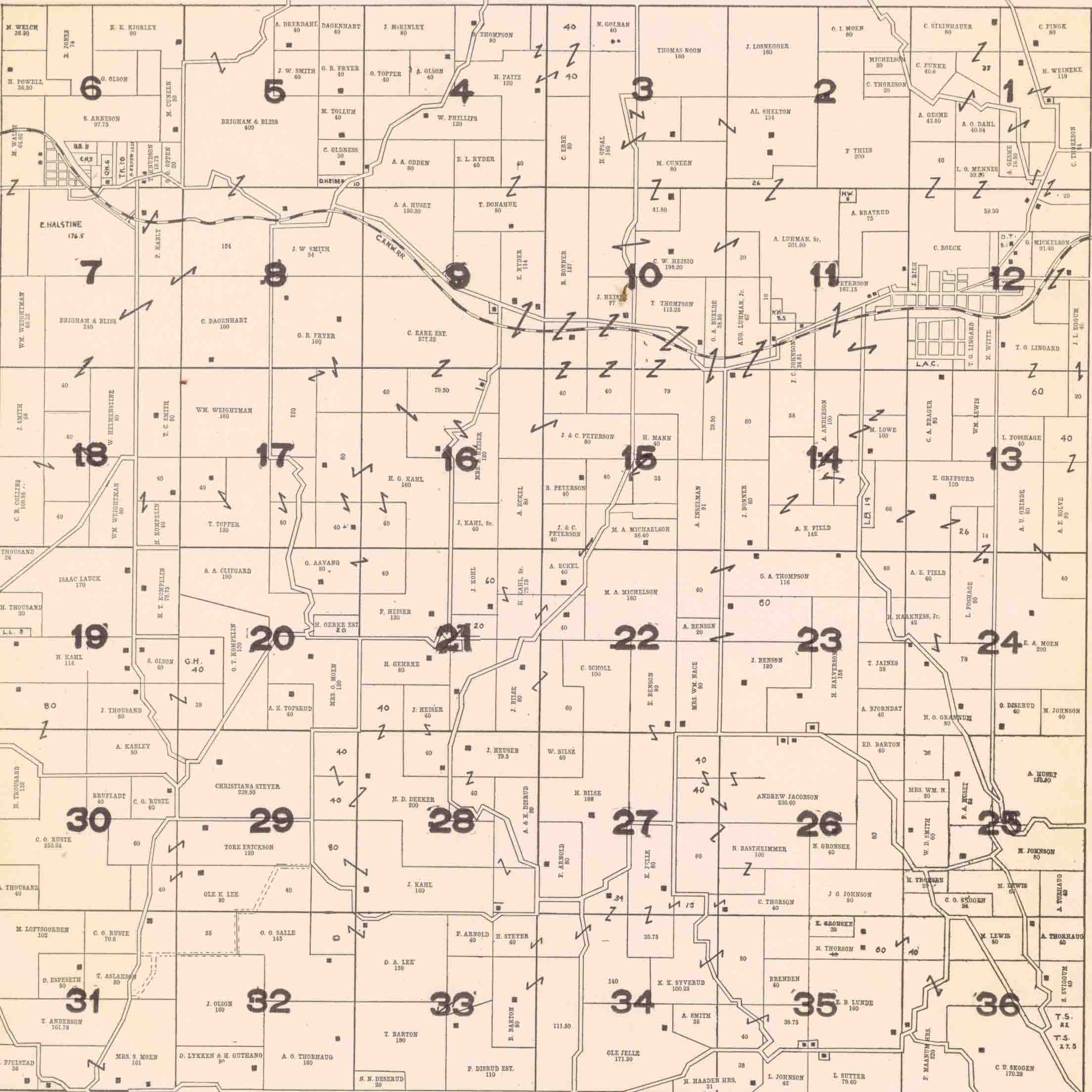
Plat maps, or land ownership maps, are exceptional research tools for genealogists and historians. These maps show names of rural landowners, property lines, and cultural features such as schools and churches.
The Society has a copy of almost every early plat map, plat book, and historical atlas published for Wisconsin counties, including the earliest plat map for Wisconsin published in 1857. It also has a scattering of early plat maps for counties in other states. The Society continues to collect current Wisconsin plat books.
Browse Digitized Plat Maps
Sanborn Fire Insurance Maps of Wisconsin Communities

Sanborn Fire Insurance Maps of Wisconsin Communities
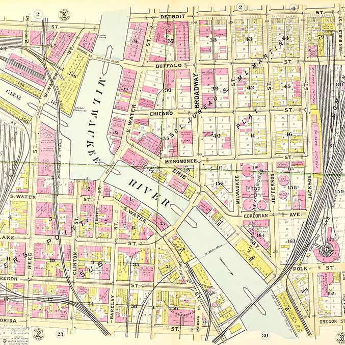
Fire insurance maps, often called Sanborn maps after their most prolific publisher, are among the most useful sources for local history. Made for all sizes of cities and villages, they are meticulous, large-scale street maps drawn at a scale of 50-feet to one-inch. The Society's archives has original Sanborn maps for 325 Wisconsin communities.
Sanborn maps helped insurance agents in the late 19th and early 20th centuries determine the degree of fire hazard associated with a particular property. Each map provides a detailed assessment of the buildings within a district. Assessments include an outline of each building and outbuilding, the size and number of stories of every building, composition of building materials, locations of windows and doors and indications of sprinkler systems. Other map features include street names, street and sidewalk widths, property boundaries, fire hydrants, locations of water and gas mains, and the names of most public buildings, churches and companies.
Most maps date between 1883 and 1930. The Society has digitized over 700 sets of its Sanborn maps (those made in 1926 and earlier). The Society is grateful to the American Geographical Society Library at the University of Wisconsin-Milwaukee for sharing their digital images of the Milwaukee Sanborn maps. Their generosity saved us from having to scan more than 1,000 large, fragile sheets in the Society's collection.
Browse Digitized Fire Insurance Maps

Bird's-Eye View Maps of Wisconsin

Bird's-Eye View Maps of Wisconsin
Bird's-eye-view maps give users an aerial view of a city or village, including streets, buildings, and major landscape features. They were popular from the 1860s until the introduction of aerial photography around 1920. Developments in printing technology along with the growth and prosperity of settlements in the post-Civil War era created a ready market for these city portraits.
The Society owns over 200 original and reproduction bird's-eye-view maps of Wisconsin cities and villages. These maps have a distorted, yet charming, perspective that combines concrete reality with promotional art. Bird's-eye-view maps are valuable resources for local history and architectural research. They provide a uniquely American vision of the urban landscape.
Browse Digitized Bird's-Eye View Maps of Wisconsin

U.S. General Land Office Surveyors' Field Notes and Plat Maps of Wisconsin

U.S. General Land Office Surveyors' Field Notes and Plat Maps of Wisconsin
Surveyors' Field Notes and Plats of Wisconsin is a collection of thousands of maps and written observations recorded between 1833 and 1866, when Wisconsin land was sub-divided into parcels for purchase and settlement. The surveyors' field notes recorded vegetation, especially tree cover; land features such as soils, streams and rock outcroppings; and evidence of human habitation including villages, cabins, trails and roads. Mapmakers at the U.S. General Land Office used these field notes to create official plat maps. The plat maps were used to sell or grant land to settlers, railroads, speculators and other interested parties. These plats represent some of the earliest attempts at mapping Wisconsin land at a local level.
For access to the 21 bound volumes of hand-drawn plat maps or microfilm copies of the field notes, visit the library and archives catalog.
The field notes and plat maps are available for viewing online through University of Wisconsin-Madison Digital Collections.
Browse Digitized Surveyor's Field Notes and Plat Maps

Wisconsin Land Economic Inventory Maps (Bordner Survey)

Wisconsin Land Economic Inventory Maps (Bordner Survey)
The Wisconsin Land Economic Inventory was a Great Depression-era project to document land resources for every survey township in Wisconsin. The Society has the original maps for each survey township mapped between 1929 and 1949.
To create these maps, field workers, usually trained foresters, crossed the land at intervals of one-half mile. They mapped current land use and land cover, signs of erosion, and size and quality of stands of timber. Included on the maps are such features as houses, schools, churches, taverns, cheese factories, filling stations, and logging camps.
When used in conjunction with the U.S. General Land Office Surveyors' Field Notes and Plats, conducted between 1833 and 1866, you can compare the Wisconsin landscape before it was settled and approximately 100 years later.
Milwaukee County was not mapped. Lincoln, Manitowoc, and Sheboygan County maps were not published. Land in Menominee County, established in 1961, is included as part of Langlade, Oconto, and Shawano Counties.
These maps are available online through UW-Madison Digital Collections.
Browse Digitized Bordner Survey Maps

George S. Parker II Map Collection

George S. Parker II Map Collection
The George S. Parker II Map Collection contains superb examples of the most significant maps related to New France and French exploration of the Great Lakes, early maps of Florida, and 19th century maps of Wisconsin. George S. Parker II, former CEO of the Parker Pen Company, acquired most maps between 1975 and 1986. Parker intended his collection to be valuable for scholars as well as the general public. His map collection was gifted to the Society by the Caxambas Foundation of Milwaukee.
Browse Digitized George S. Parker II Map Collection
Reference Maps of Wisconsin
Reference Maps of Wisconsin
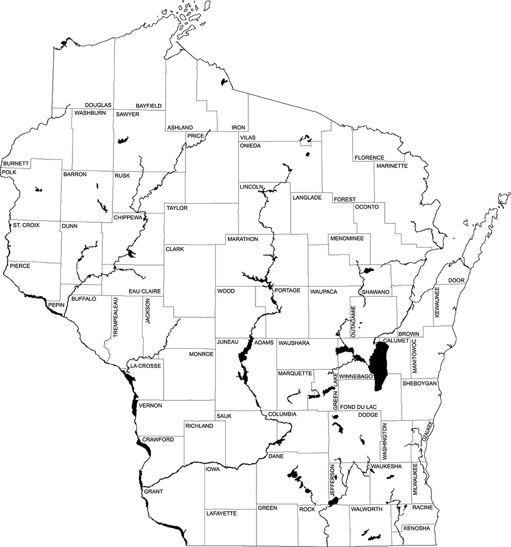
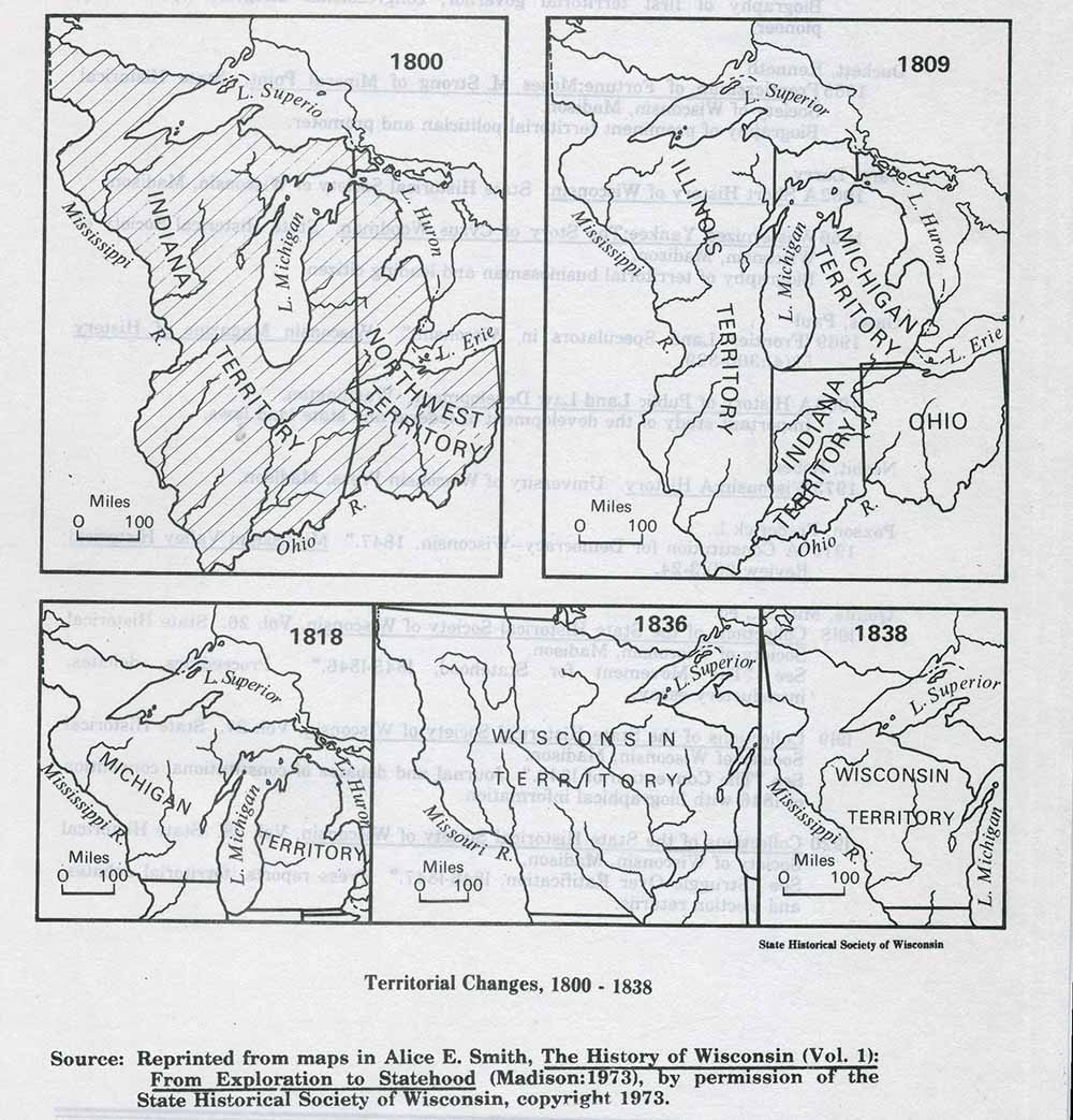
Reference maps of Wisconsin show basic cultural and geographical data about Wisconsin and its history. The maps are primarily intended for teachers, students, and others needing answers to simple questions such as: Where were Wisconsin's Indigenous Peoples living when the first white explorers arrived? In what parts of the state did German immigrants settle? Where were Wisconsin's first roads? Can I print a map of all Wisconsin counties and county seats?
The Society has digitized almost 200 reference maps of the state.
Browse Digitized Reference Maps
Explore Maps & Atlases

(Tentative) District Map for Village of Hustisford, Dodge County, Wisconsin
November 15, 1957
This map shows single family residence district, business district, and manufacturing district, as well as block and lot numbers, Hustis Homestead, a gravel pit, bridge, dam, park, and cemetery. Si...

100 Valuable Building Lots in Belmont
1836
This map of Belmont shows lots to be sold at auction by Van Antwerp and Van Dyke on Monday, 3rd Oct. 1836. The map also labels streets and public land. Iowa County was later split and Belmont becam...

100 Valuable Building Lots in Belmont, Iowa County, Wisconsin Territory, the County Seat
1836
This plat map of Belmont shows lot and block numbers and streets. It includes a notarization from the justice of the peace of Iowa County, dated May 15, 1836, acknowledging John Atchison as proprie...

1858 Map of Racine County, Wisconsin
1972
This facsimile of an 1858 map of Racine County features a title page sheet with a business directory. The map shows section numbers, roads, railroads, saw mills, churches, blacksmith shops, timber ...

1890 Madison Plat Map
1890
Plat map of Madison, T7N R9E, including portions of the towns of Blooming Grove and Burke. Includes inset maps of South Madison, Quarrytown, Marril Park, and the Oak Lawn and Pleasant View addition...

1930 Official Road Map, Wisconsin
1930
This map of Wisconsin shows county boundaries, cities, roads and highways, points of interest, and the locations of Standard Oil Company service stations. Included are adjacent portions of Minnesot...

1934 Official Road Map, Wisconsin
1934
This road map of Wisconsin was compliments of Phillips Petroleum Company. It shows roads and highways, mileages, state parks, points of interest, and airports and landing fields. The front side inc...

1937 Official Road Map, Wisconsin
1937
This map shows the major cities, towns, highways, roads, lakes, and rivers of Wisconsin and parts of the neighboring states. An index of cities and towns is included on the front. The back contains...

1956 Map of the City of Madison, Dane County, Wisconsin
1956
This map shows local streets, roads, railroads, highways, city limits, parks, cemeteries, hospitals, country clubs, and fair grounds. It also covers Middleton, Maple Bluff, Shorewood Hills, Monona,...

1959 Wards & Precincts
1959
This map shows wards and precincts by number, local streets, roads, parks, Shorewood Hills, Maple Bluff, Middleton, Verona, McFarland, Monona, Truax Field, Lake Mendota, Lake Monona, Lake Wingra, a...

A Bird's-Eye View of the City of Antigo, Wis.
1886
This bird’s-eye-view map of Antigo gives an illustrated view of the city. The lower margin includes a key to points of interest, public buildings, and selected businesses. "Population 2500."

A Bird's-Eye View of the City of Ashland, Wis. County Seat of Ashland Co.
1886
Bird's-eye view of Ashland, on the shores of Lake Superior, with insets of The Apostle Islands Chequamagon Bay & Ashland, and Distances from Ashland.
Collections Use FAQs
Explore how you can find, access, and use our collection materials.
The Society's library and archives collections can be searched in the University of Wisconsin-Madison Library catalog and some parts of our collections have been digitized and are available online.
The Society's historical object collection cannot be searched online.
Library & Archives
Many books, bound periodicals, microforms and government publications may be checked out for home use with a library card. Rare, fragile, small and heavily used materials (including genealogical resources) do not circulate. A borrowing card is not required if you want to use materials within the Library. Archival materials are available for use in our Archives Reading Room.
For more information about our borrowing policies Library & Archives Services.
Historic Objects
If you are interested in viewing our historical objects please contact us.
Due to significant demands associated with developing the Wisconsin History Center, the Society has reduced capacity to handle loan requests. Therefore, we are not accepting new requests at this time.
For a credit line: Wisconsin Historical Society, Creator, Title, Unique Identifier.
The Unique Identifier can be found at the top or bottom of the webpage for each item. The name of a downloaded file is NOT the unique identifier.
For bibliographic citations please consult the UW-Madison Libraries Citation Research Guide to ensure compliance with appropriate style guidelines.
-
Personal use (prints, gifts, home and study): Request images for personal use
-
Commercial use (public display, publishing, media, products, film and more): Request commercial use of our Collection
Materials in our websites and digital collection are provided for research, teaching, and private study. The Wisconsin Historical Society hold rights to some items; others may be governed by additional copyright or donor restrictions.
We encourage users to download low-res images from our website for personal or classroom use, without written permission, within the meaning of the principles of “Fair Use.”
Permission is required for reproduction, publication, or commercial use of any content made available through our websites and digital collection. By using this website, including our digital collections, you agree to the Terms of Use. Users are responsible for determining whether their intended use qualifies as fair use under U.S. copyright law. When relying on fair use, cite the source.
Visit Our
Library & Archives
Perhaps the best way to begin exploring our collections is by visiting us in person. In our reading rooms, you’ll find free and unparalleled access to our collections, helpful staff and amenities, and perhaps, your very own story.
Plan Your Visit Hours
Donate to The Society's Collections
Your Story is Wisconsin's Story
History is made every day, everywhere. Since 1846, contributions from people across the state have helped us fulfill our mission to collect, preserve and tell the stories of Wisconsin.
Find Out How





