 Filter: Community of Greenfield
| Community: | Greenfield |
|---|---|
| County: | Sauk |
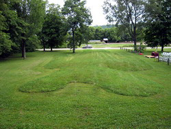
| Historic Name: | Man Mound (additional documentation and boundary expansion) |
| Reference Number: | 10000211 |
| Community: | Greenfield |
|---|---|
| County: | Sauk |
| Historic Name: | Man Mound |
| Reference Number: | 78000138 |
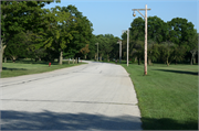
| Community: | Greenfield |
|---|---|
| County: | Milwaukee |
| Historic Name: | Root River Parkway |
| Reference Number: | 12001253 |
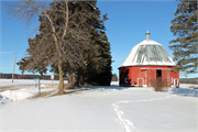
| Community: | Greenfield |
|---|---|
| County: | Sauk |
| Historic Name: | Simonds 10-Sided Barn |
| Reference Number: | 100005183 |

| Date: | 03 27 1989 |
|---|---|
| Description: | Father on a bicycle towing son on a scooter. |
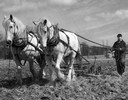
| Date: | 04 10 1935 |
|---|---|
| Description: | Two horses pull a spring tooth harrow. The farmer plans to plant barley. |
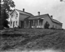
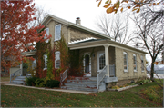
| Date: | 1909 |
|---|---|
| Description: | Exterior of Huntington House with large front porch. |
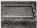
| Date: | 1963 |
|---|---|
| Description: | The marker notes Man Mound Park by the Wisconsin Archeological Society, Sauk County Historical Society and the Landmark Committee, W.F.W.C. |
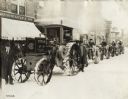
| Date: | 01 1917 |
|---|---|
| Description: | Several tractors, including a Titan 15-30, lined up along a curb near storefronts on a snow-covered Washington Street in downtown Greenfield. One of the st... |
| Date: | |
|---|---|
| Description: | Elevated view of Man Mound outlined in chalk looking south. A road bisects the legs of the effigy mound. A small outbuilding can be seen at left in the for... |
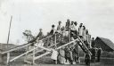
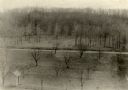
| Date: | 1919 |
|---|---|
| Description: | A group of children posing on and beneath a wooden playground slide. There is a barn in the background. |

| Origin of Greenfield, Wisconsin |
|---|
| Discover the history of Greenfield, Wisconsin. |
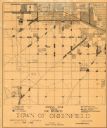
| Date: | 1930 |
|---|---|
| Description: | This map shows 6 types of zones, as well as cemeteries and streets and includes portions of Greenfield, West Allis, West Milwaukee, and the city of Milwauk... |
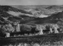
| Date: | 1953 |
|---|---|
| Description: | Elevated view along a hillside into a valley, with forests, buildings, and crop fields. Caption reads: "Barree Coulee from St. Joseph's Ridge, La Crosse Co... |
| Community: | Greenfield |
|---|---|
| County: | Milwaukee |
| Historic Name: | Henry Lieber House (Winery) |
| Reference Number: | 108226 |
| Community: | Greenfield |
|---|---|
| County: | Milwaukee |
| Historic Name: | Leonard and Rosina Weiler House |
| Reference Number: | 108227 |
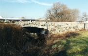
| Community: | Greenfield |
|---|---|
| County: | Milwaukee |
| Historic Name: | Root River Bridge |
| Reference Number: | 118444 |
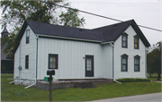
| Community: | Greenfield |
|---|---|
| County: | Milwaukee |
| Historic Name: | Schmitz-Toelle Farmstead - House |
| Reference Number: | 11909 |
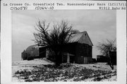
| Community: | Greenfield |
|---|---|
| County: | La Crosse |
| Historic Name: | Muenzenberger Barn |
| Reference Number: | 130581 |
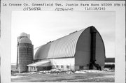
| Community: | Greenfield |
|---|---|
| County: | La Crosse |
| Historic Name: | Emil Justin Farm |
| Reference Number: | 130582 |
If you didn't find the material you searched for, our Library Reference Staff can help.
Call our reference desk at 608-264-6535 or email us at: