 Filter: Categories of Wisconsin Historical Images
Filter: State of Georgia
Filter: Type of Map or Atlas
Filter: Categories of Wisconsin Historical Images
Filter: State of Georgia
Filter: Type of Map or Atlas

| Date: | 1864 |
|---|---|
| Description: | This map of the Atlanta area shows entrenchments, relief by hachures, vegetation, drainage, roads, railroads, towns, and the names of a few residents in th... |
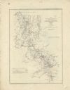
| Date: | 1864 |
|---|---|
| Description: | This map of northwestern Georgia shows dates and troop positions between Chattanooga, Tennessee, and Jonesboro, Georgia, May-September, 1864. Wisconsin uni... |
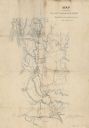
| Date: | 1864 |
|---|---|
| Description: | This map illustrates the route taken by the 3rd Division, 20th Corps, Army of the Cumberland under the command of Daniel Butterfield from the Snake Creek G... |

| Date: | 1865 |
|---|---|
| Description: | Detailed map of the southeastern United States showing fortifications, "movements of Genl. J.H. Wilson's Cavalry Corps," "pursuit of Hood" and the lines of... |

| Date: | 1865 |
|---|---|
| Description: | This pen and ink map sketches the route taken by General Sherman's troops from Atlanta, Georgia, to Savannah, Georgia. Railroads, rivers, and towns are lab... |

| Date: | |
|---|---|
| Description: | This detailed map shows fortifications, headquarters, location and dates of battles, street outline of Atlanta, roads, railroads, vegetation, drainage, rel... |

| Date: | 1865 |
|---|---|
| Description: | This map shows fortifications, headquarters, and location and dates of battles. Relief is shown by hachures. A list of authorities is included. Blue lines ... |

| Date: | 1779 |
|---|---|
| Description: | Map of colonial Georgia showing cities, towns, Native American land and towns, forts, roads, trading paths, islands, mountains, swamps, and rivers. Annotat... |

| Date: | 1795 |
|---|---|
| Description: | Map of Georgia, with its borders extending to the Mississippi River. It shows borders, various boundary lines, counties, cities, towns, Native American lan... |
If you didn't find the material you searched for, our Library Reference Staff can help.
Call our reference desk at 608-264-6535 or email us at: