 Filter: Categories of Wisconsin Historical Images
Filter: Subject of Surveying
Filter: County of Lafayette
Filter: Categories of Wisconsin Historical Images
Filter: Subject of Surveying
Filter: County of Lafayette

| Date: | 1874 |
|---|---|
| Description: | Map of New Diggings — inset map in bottom right corner of "Benton & New Diggings" map, on page 11 of "Atlas of Lafayette County Wisconsin," a collect... |

| Date: | 1882 |
|---|---|
| Description: | Plat map of the village of Dunbarton, received by the Lafayette County Register's Office on September 22, 1892. Certification by the surveyor, Albert Pool,... |
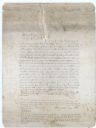
| Date: | 1882 |
|---|---|
| Description: | Note from Albert Pool, surveyor for the village of Dunbarton in Lafayette County, as appears on the reverse of the Village of Dunbarton plat map. Pool cert... |

| Date: | 1836 |
|---|---|
| Description: | This map is ink and watercolor on paper and shows a plat of a paper city (a city planned but never built). Some streets and the Pekatolica River are labele... |
If you didn't find the material you searched for, our Library Reference Staff can help.
Call our reference desk at 608-264-6535 or email us at: