 Filter: Categories of Wisconsin Historical Images
Filter: Subject of Streams
Filter: Subject of transportation
Filter: Categories of Wisconsin Historical Images
Filter: Subject of Streams
Filter: Subject of transportation

| Date: | 1936 |
|---|---|
| Description: | This map is red and black ink on tracing cloth and is oriented with north to the upper left. This hand-drawn map shows a central portion of the military ro... |
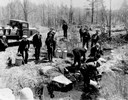
| Date: | 04 26 1936 |
|---|---|
| Description: | Planting trout in Waupaca County. Left to right on bank: S.A. LaVoilette, Joe Samz, Lloyd Pinkawski, Edwin Kargewski, W.M. Geiger, G. Moder, Billy LaVoilet... |

| Date: | 1874 |
|---|---|
| Description: | This map shows lakes, rivers, state, county, and town boundaries, as well as railroads completed, in progress, and contemplated. The map includes a color d... |
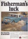
| Date: | 1966 |
|---|---|
| Description: | Advertising poster for the International Scout 800 truck. Includes a color photograph of the two men in a truck crossing a stream and the text: "Fisherman'... |
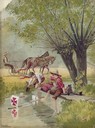
| Date: | 1896 |
|---|---|
| Description: | Back cover of an advertising catalog for the Milwaukee Harvester Company. The cover features a color chromolithograph illustration of young boys racing hom... |

| Date: | 1871 |
|---|---|
| Description: | Birds eye map of Brodhead, WI depicts street names and street locations, houses, and trees. A reference key at the bottom of the map shows the locations of... |
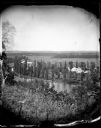
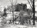
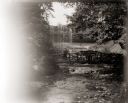
| Date: | |
|---|---|
| Description: | View from hill over a valley dotted with farmsteads and a meandering stream in the foreground. A group of three or four people are posing at the opposite s... |
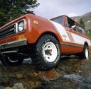
| Date: | 1978 |
|---|---|
| Description: | Color advertising photograph of an International Scout truck. |

| Date: | 1876 |
|---|---|
| Description: | View of a farmstead with fences, haystacks and a wooden outbuilding. Two men are posing on top of McCord Rock, one of them saluting with his hat. Another ... |

| Date: | 1874 |
|---|---|
| Description: | Elevated view from hill of Clinton, now Rockdale. Three men are in the middle distance, looking east across Koshonong Creek towards a mill dam, bridge and ... |
| Date: | 1955 |
|---|---|
| Description: | Wheeler Hall at Northland College, during winter. A group of people are on a bridge over the Bay City Creek, surrounded by trees, in the foreground. Wheele... |

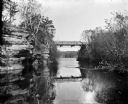
| Date: | 1950 |
|---|---|
| Description: | Aerial view of main street. There is a bridge with a stream flowing under it in the foreground. |
| Date: | 1909 |
|---|---|
| Description: | View from river of Dell Creek bridge with bluff and birch trees on the left. |
| Date: | 1914 |
|---|---|
| Description: | Cover of an advertising catalog for Deering Corn Machines manufactured by International Harvester. Features an illustration of a small bridge over a stream... |
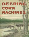
| Date: | 1900 |
|---|---|
| Description: | Unidentified woman standing on the footbridge at the base of Minnehaha Falls. Minnehaha Creek in foreground. |
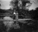
| Date: | |
|---|---|
| Description: | Two women wearing fashionable hats stand on a footbridge over a stream. |
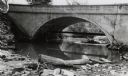
| Date: | 06 02 1943 |
|---|---|
| Description: | View from shoreline of bridge and stream. |
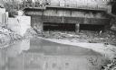
| Date: | 06 02 1943 |
|---|---|
| Description: | Behind the drugstore, looking downstream. The water under the bridge is full of construction debris. |
| Date: | |
|---|---|
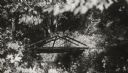
| Description: | Rustic log footbridge over a creek in the woods. |
| Date: | |
|---|---|
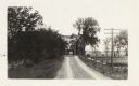
| Description: | The Milwaukee Journal Pathfinder car driving from a road onto a bridge. |
If you didn't find the material you searched for, our Library Reference Staff can help.
Call our reference desk at 608-264-6535 or email us at: