Filter: Categories of Wisconsin Historical Images
Filter: Subject of Rivers
Filter: County of Columbia
Filter: Categories of Wisconsin Historical Images
Filter: Subject of Rivers
Filter: County of Columbia

| Date: | 1936 |
|---|---|
| Description: | This map is red and black ink on tracing cloth and is oriented with north to the upper left. This hand-drawn map shows a central portion of the military ro... |

| Date: | 1910 |
|---|---|
| Description: | View down the canal, with buildings along the shoreline, and a boat coming down the canal. |

| Date: | 1831 |
|---|---|
| Description: | Drawing of Fort Winnebago (near present-day Portage) that illustrated "Wau-Bun," Juliette Kinzie's memoir of her experiences on the early Wisconsin fronti... |
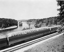
| Date: | 1953 |
|---|---|
| Description: | Exterior view of the Milwaukee Railroad superdome passenger car passing through the Wisconsin Dells. |
| Date: | |
|---|---|
| Description: | Spearing sturgeon at the dam in Kilbourn. There is a man with a sturgeon on a spear in the foreground, and another man with a spear is in the background. A... |
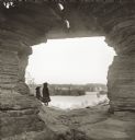
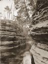
| Date: | |
|---|---|
| Description: | Luncheon Hall, looking towards Witches' Gulch, with Miriam Bennett and Ruth Bennett. |
| Date: | |
|---|---|
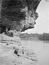
| Description: | Jaws, from Stone Pile. Two children wearing straw hats are sitting on rocks in the foreground. A canoe is pulled up on a sandy bank in the background. |
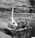
| Date: | |
|---|---|
| Description: | Ashley Bennett and three friends in a homemade sailboat. This was captioned: "Going to Join the Navy." |
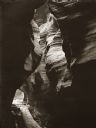
| Date: | |
|---|---|
| Description: | Witches' Gulch, looking out of Phantom Chamber. Wooden walkway through chamber. |
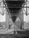
| Date: | |
|---|---|
| Description: | Interior of railroad bridge, with walkway below. There is a man standing on the left at the railing of the walkway. |
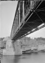
| Date: | |
|---|---|
| Description: | View of the river and the underside of a railroad bridge at Kilbourn. There is a building in the background on the right just above the cliffs along the ri... |
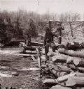
| Date: | |
|---|---|
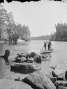
| Description: | Robinson's Landing; view up the river, with a man in uniform standing in a canoe. There is a man on the ledge above. |
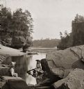
| Date: | |
|---|---|
| Description: | Channel behind Steamboat Rock, from a steamboat. Man sitting on rock ledge on right. |
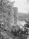
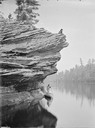
| Date: | |
|---|---|
| Description: | Man in dark suit and hat reclining on Angel Rock and looking down the river. There is a bridge in the distance. |
| Date: | |
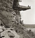
|---|---|
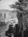
| Description: | Elevated view of High Rock from Romance Cliff. |
| Date: | |
|---|---|
| Description: | Looking downstream through the Jaws. Two men are standing in a canoe, each holding an oar. |
| Date: | |
|---|---|
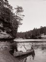
| Description: | Two men dressed as "Indians" are sitting in a canoe at the edge of the beach. One is posing holding a bow and arrow, the other is holding a paddle. |
If you didn't find the material you searched for, our Library Reference Staff can help.
Call our reference desk at 608-264-6535 or email us at: